
HOA Management services in Rock Hill, SC
William Douglas Management is a leader in customer service — the experience and expertise that your association needs and deserves!
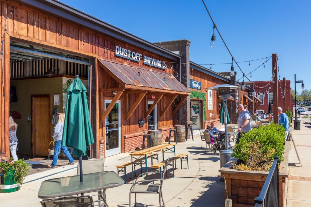
Rock Hill, South Carolina, or the City of Rock Hill, is located in York County
Saluda, NC Facts & Information
Rock Hill, South Carolina, or the City of Rock Hill, is located in York County and is the largest municipality in the county. Rock Hill is a suburb of Charlotte and is around 19 miles from downtown Charlotte. Per the U.S. Census, Rock Hill’s 2019 estimated population was 75,048. Rock Hill has two nicknames, “The Gateway to South Carolina” and “Football City USA.” The zip codes for Rock Hill are 29730, 29731, 29732, 29733, and 29734. The area codes are 803 and 839.
Rock Hill was founded in 1852 and incorporated in 1892. The city was founded because the nearby town of Ebenezer (also known as Ebenezerville) refused to allow the Charlotte and the South Carolina Railroad to lay tracks through their town. The citizens of Ebenezer considered a railroad a nuisance, so the railroad laid their tracks a little over two miles to the south of their town. Legend has it that the railroad marked an area along those tracks as “rocky hill,” and this is what became the City of Rock Hill. In the 1960s, the town of Ebenezer ceased to exist when it was unincorporated and annexed into Rock Hill.
Rock Hill, South Carolina
Historical population
Census Pop. %±
1880 809 —
1890 2,744 239.2%
1900 5,485 99.9%
1910 7,216 31.6%
1920 8,809 22.1%
1930 11,322 28.5%
1940 15,009 32.6%
1950 24,502 63.2%
1960 29,404 20.0%
1970 33,846 15.1%
1980 35,327 4.4%
1990 41,643 17.9%
2000 49,765 19.5%
2010 66,154 32.9%
2019 75,048 (est.) 13.4%
As of 2019, per the U.S. Census estimates, Rock Hill’s median annual income for a household was $50,444. Per capita income in the past 12 months (2019) was $27,959. The median home value was $155,800.
A Brief History of the Rock Hill Area
The first recorded inhabitants of the Rock Hill area were the Catawba Indians. They are also known as the Issa, Essa, or Iswä. Iswä in the Catawba language translates to “people of the river.” This is due to the Catawba Indians living along the river now known as the Catawba River. The Catawba River is located in the northeast portion of Rock Hill’s city limits.
It is estimated that in pre-American colonial times, there were up to 25,000 Catawba Indian inhabitants in the Piedmont region. When Europeans began arriving in mass, diseases (primarily smallpox) that the Catawbas had not been exposed to before devastated the tribe’s population. Beginning around 1680,
these diseases tragically reduced the Catawba population to around 400 by 1775 through the tribe’s continual contact with European settlers. The Catawba Indian population has only rebounded to 2,600 according to the U.S. Census of 2010.
There are not many historical written records from the Catawbas before the 17th century. The first recorded European contact with the Catawbas was by Spanish explorer Hernando de Soto in 1540. The next European contact was believed to be by Spanish explorer Juan Pardo in 1567. This can be found in Vandera’s narratives of Pardo’s expedition, where the Catawba are referred to as Ysa Issa (Iswa). The third contact was reportedly made by the German explorer John Lederer in his expedition of 1670, and he referred to them as the Ushery. It is believed the Catawba Indians inhabited the lands along the Catawba River for 6,000 years within the Piedmont regions from South Carolina up to Virginia.
The Catawbas were considered an agrarian-based civilization, who fished and hunted to subsidize their diet. Their society was organized within villages that were surrounded by walls constructed of logs and tree branches. These walls were constructed to protect the village from warring Indian tribes. Within the walls of the village, there was a council house with a large open area for tribe gatherings and small dwellings that were rounded at the top and constructed of tree bark. These dwellings typically housed the extended family. The sweat lodge played an important part in the Catawba Indians’ culture. It was common for there to be a circular stone sweat lodge within these walled villages.
In the 17th century, trading between the Catawbas and the settlers had a major impact on the Catawba civilization. Catawba trade goods included deerskins and other animal furs. The colonies traded firearms, knives, cloth, trinkets, and alcohol. The Catawba Indians became well known for their trading abilities and their proclivity for commerce.
The Catawbas were known as a peaceful society but ferocious warriors. Catawbas, being a large and powerful tribe, would wage war with other tribes. Since they were both large tribes with bordering territories, the Cherokee Indians and the Catawba Indians often had conflicts. With a few exceptions, the Catawbas were friendly with the European settlers. Due to this, up until the American Revolution,
the Catawbas had a good relationship with the British Crown during their colonization of the American colonies.
This good relationship helped maintain peace as settlers migrated to the Piedmont area of South Carolina and North Carolina during the 18th century. The good relations and the commerce were beneficial to both the settlers and the Catawbas. The Catawba protected the settlers from other tribes who were hostile to the settler’s migration. The Catawbas’ commerce abilities aided their society to a greater extent than other tribes. For a time, the Catawbas flourished to a much higher degree than most other tribes. The best example of this is the Catawba Indian’s access to firearms before rival tribes.
The future Rock Hill area was part of a 144,000-acre land grant in 1763 from England’s King George III to the Catawba Indians. In the Treaty of Augusta, the Catawba Indians received 144,000 acres in what is now York County, the area now encompassing the City of Rock Hill. This land grant was in appreciation of the Catawba’s support of the British during the French and Indian War. The Catawba Indians already considered the land theirs before the land grant. However, it was hoped that the Treaty of Augusta would keep European settlers from encroaching further onto the Catawba’s land. In this regard, the treaty was unsuccessful.
The erosion of the treaty began shortly after the treaty was signed when the Catawbas began leasing parcels of the 144,000 acres out to settlers. The size of these leased parcels reportedly ranged from 30 to 1,000 acres per settler. However, there are instances where some settlers leased much larger parcels. The first European settlers on these 144,000 acres were farmers Thomas and Elizabeth Spratt, who leased several 1,000 acres. Their descendants still reside in the Rock Hill area. United States House of Representative John Spratt represented South Carolina’s fifth congressional district from 1983 to 2011. The original 144,000-acre Catawba reservation is within the fifth congressional district.
During the American Revolution, the Catawba Indians supported the Patriot cause. It was during the American Revolution that smallpox epidemics plagued the American colonial populations. Tragically, by all indications, the Native American populations were affected much more severely than the colonial population of European descent. Smallpox devastated the Catawbas, and by 1775, their number had been reduced to 400. The Catawba’s population has never recovered. The drastic drop in their population forced many Catawba Indians to temporarily join other tribes that had not been as drastically affected by the epidemics. Some Catawbas remained on their tribal reservation in York County.

In the early 19th century, the settlers or their descendants, who had leased the reservation land, pressed the South Carolina legislature to force the Catawbas to relinquish the 144,000 acres. The dwindling number of Catawba Indians and the political environment led to the Treaty at Nations Ford in 1840 with the state of South Carolina. This treaty mandated the Catawbas relinquish the 144,000-acre reservation to the State of South Carolina. The terms and conditions of the treaty were not in favor of the Catawbas, and this treaty was ratified in the shadow of the federal Indian Removal Act of 1830. The Indian Removal Act can be summarized in the “Indian Problem” from the National Museum of the American Indian: “When you move a people from one place to another, when you displace people, when you wrench people from their homelands … wasn’t that genocide? We don’t make the case that there was genocide. We know there was. Yet here we are.”
In the Treaty at Nations Ford, the Catawbas were promised a new reservation in another area of South Carolina. The treaty also required the Catawbas to be financially compensated. This treaty and the aftermath were not resolved until 1993 when the state of South Carolina settled with the Catawba Indians for $50 million.
The early settlers to York County and the future Rock Hill area were predominately Scots-Irish in the 1750s and 1760s. The majority of these arrived from Pennsylvania via the Great Wagon Road. There were rough colonial roads and trails into the interior of South Carolina; however, immigration from the South Carolina coast did not play the role that the Great Wagon Road did in the Carolinas. The higher volume of shipping into Philadelphia compared to South Carolina also played a large part in the immigration down the Great Wagon Road.
The village of Rock Hill was founded in 1852, as discussed, because the town of Ebenezer did not want the Charlotte and the South Carolina Railroad to lay tracks near their town. Most towns and cities grew drastically because of the railroads. In fact, Rock Hill probably only exists because of the railroad. The Charlotte and the South Carolina Railroad was the first railroad to serve York County, and it eventually ran for 110 miles.
The Charlotte and South Carolina Railroad put down tracks through what would become Rock Hill in 1852. The network of this railroad was between Charlotte, North Carolina and Columbia, South Carolina. The 1854 daily rail schedule for Monday through Saturday listed a departure from Charlotte at 4:40 a.m., arriving in Columbia at 11:15 a.m., departing Columbia at 4:20 p.m., and arriving in Charlotte at Midnight. There was no scheduled service on Sundays. The roundtrip fare was $2.00.
This railroad was financed by area businessmen who needed a better method of transporting their products to market. There was already an existing rail line between Columbia and Charleston that opened in 1842. The Charlotte and the South Carolina Railroad would connect the region to the Charleston port to open up more domestic and international markets for the region’s products. During this period, the primary product was cotton.
The Springs and White families of the area were investors in the Charlotte and the South Carolina Railroad and a driving force in the development of the railroad. Large cotton planter John Springs, III was an initial investor. The White family were cotton planters too and benefited greatly from the railroad. The Charlotte and the South Carolina Railroad has been recognized as the most important economic determinants for Charlotte and the surrounding areas in the region’s history.
The primary economic activity in the Rock Hill area for most of the 18th and 19th centuries was agriculture. Cotton became more prevalent in the 1830s and 1840s, and this cultivation of cotton remained the primary crop well into the 20th century. An exception to this was during the American Civil War when corn was cultivated because cotton could not be exported. However, cotton was always the leading cash crop. (A cash crop is a crop grown solely to sell for a profit and not consumption by the farmer.)
The area’s economic dependence on agriculture slowly waned in the late 1800s with the introduction of textile manufacturing. At the turn of the 20th century, the textile industry was the leading economic driver in Rock Hill and the surrounding areas. This all changed in the 1980s and 1990s when imported textiles began to dominate domestic textile production. The North American Free Trade Agreement (NAFTA), the trade agreement between the United States, Canada, and Mexico that was ratified in 1993, was one factor that expedited the decline of domestic textile production. Decreasing employment trends in textile manufacturing had already been occurring; however, NAFTA exacerbated this decline.

One remnant of this era is the Rock Hill Cotton Factory (also known as the Fewell Cotton Warehouse) located at 215 Chatham Street and 130 W. White Street, Rock Hill. The Rock Hill Cotton Factory is a former textile mill and textile warehouse constructed in 1881. No longer a textile manufacturing facility, it is now home to retail and office space and is known as the Cotton Factory Plaza. In 1992, it was listed on the National Register of Historic Places.
Even with the reduction in agriculture cultivation and the decline of textile manufacturing in Rock Hill and the surrounding area, the overall economy rebounded quickly. Two factors attribute to this: first, the diverse industrial base that has developed in Rock Hill and York County and second, the proximity to the strong economic development of Charlotte.
Rock Hill, many of the areas south of the North Carolina line, has become a bedroom community for the Charlotte workforce. A huge attraction for these commuters is the school system and the lower taxes. Due to lower taxes and the South Carolina state business development incentives, there has been a lot of economic progress on the South Carolina side of the border.
Education in Rock Hill
York County School District 3 oversees primary and secondary education within Rock Hill.
Legion Collegiate Academy
There are a total of 27 schools in the city. Nineteen of these are elementary schools, five are middle schools, and three are high schools.
Middle schools:
Dutchman Creek Middle School
Charter schools:
Northwestern High School
Castle Heights Middle School
Saluda Trail Middle School
Sullivan Middle School
Rock Hill High School
High schools:
York Preparatory Academy
Legion Collegiate Academy
Private schools:
South Pointe High School
St. Anne’s Catholic School
Westminster Catawba
Rawlinson Road Middle School
Post-secondary schools
Winthrop University was founded in 1886 as a women’s college, and it is now a public, co-ed university with a student body of around 6,000.
Clinton College was founded in 1894 by the African Methodist Episcopal Zion Church. It is a
historically black post-secondary institution offering two-year and four-year degrees.
York Technical College was established in 1964 and offers two-year associate degrees and continuing education courses. Enrollment is annually between 5,000 and 7,000 students.
Need Association Management?
Contact Us
How to Start
The Process of Working With Us


REQUEST A PROPOSAL
Request a proposal online or call us directly.


WE WILL REVIEW YOUR CASE
Our team of highly trained professionals will review your case.


RECEIVE A CUSTOM TAILORED PLAN
We will create a customized management plan for your community.


SEAMLESS TRANSITION
We will implement a seamless management transition and integrate our tech.


SIT BACK & RELAX
Enjoy better, affordable and a more reliable, hassle-free management system.
OUR REVIEWS
What Our Clients Say

We never lived in an area where they had HOA’s or property management companies before, so this is all new to us. Our experience with William Douglas PMC is kind of limited, but in recent months we have dealt with it more because our subdivision is being turned over to what will be our HOA very soon. I’ve had questions and each time I’ve contacted WDPMC I have received a timely response.

As Treasurer of our HOA, it’s a pleasure to work with William Douglas Property Management. They make our life so much easier!

This company has helped save our neighborhood.