
HOA Management in Carrboro, NC
Carrboro, North Carolina, or the Town of Carrboro, is located in Orange County. Carrboro was founded in 1882 and incorporated in 1911. Today the town encompasses an area of 6.51 square miles. The zip code for Carrboro is 27510. The area code for Carrboro is 919.
Carrboro was named for North Carolina industrialist Julian Shakespeare Carr (October 12, 1845 – April 29, 1924). Carr, was a very controversial figure in history for his numerous public bigoted remarks and actions against African Americans.
Carrboro was originally named “West End,” presumably by being located due west of neighboring Chapel Hill. It was founded ‘or first settled’ in 1882 at literally, the end of the line. The end of the line being the rail line for the State University Railroad. The State University Railroad is a 10.2-mile-long rail line. The rail service began on January 1, 1882, offering twice a day service between University Station Glenn – North Carolina (near Hillsborough), and West End.
On the Chapel Hill part of the line, state statute mandated the rail line must end at least a mile from the University of North Carolina campus. This was done in order for the students at the University of North Carolina not to be tempted from their studies. The University of North Carolina trustees believed their students should be as far from city temptations as possible or at least one mile. It took the railroad over twenty years to finally build a depot at West End. For the first twenty years, an old boxcar was used as the depot. Into the 20th century, the sign on the depot stated, “Chapel Hill Station.” This railway company is still in existence as a Norfolk Southern subsidiary.
The completion of the rail line had a significant economic impact on West End and the surrounding area. With the railroad, the farmers immediately had an economical and efficient method to move their goods to market. In this area cotton, grains, and tobacco would have been the common farm goods shipped before and after the turn of the 20th century. In the 1920s and 1930s, the railroad depot became a major distribution point for the local lumber industry and the railroad hardwood crossties they produced.
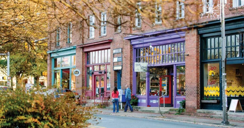
Commercial activity around West End grew continually after 1882. In 1883, a steam-powered grist mill and cotton gin was constructed north of the station. A flour mill was added around 1886. Agricultural warehouses were constructed. A blacksmith shop soon followed along with a general store. The commercial activity resulted in residential homes being built for the workers.
The continued growth of West End follows the traditional pattern of many small towns in America when the railroad arrives. Commerce increases and the population increases to take advantage of the commerce, and commerce increases because the population increases, and so on. In 1898, Thomas F. Lloyd (West End would briefly be called Lloydville in 1900 in his honor.) constructed a steam-powered grist mill in West End. This mill would become the Alberta Cotton Mill.
In 1909, Julian Shakespeare Carr bought this mill and added it to his other textile mills which became Durham Hosiery Mills. West End incorporated their community and changed the name to “Venable.” This was in honor of Francis Preston Venable, the University of North Carolina president. However, two years later the name of the town was changed once again, this time to Carrboro. This was in recognition of him providing electricity for the town and expanding his textile mill operations in town.
As the Great Depression affected the United States and the rest of the world, Carrboro was economically impacted as well. Julian Shakespeare Carr’s Durham Hosiery Mills declined during this period as well. In 1930, the company was forced to close the original Alberta Cotton Mill, Mill No. 4. Passenger service on the railroad ceased in 1936. Durham Hosiery Mills closed Mill No. 7 and closed all operations by 1938.
The Occaneechi, Shoccoree, and Eno native American tribes were the first recorded inhabitants of what is now Orange County, North Carolina. These tribes were encountered by John Lawson (December 27, 1674 – September 16, 1711), the first European explorer of the Carolina backcountry. In 1701, Lawson while traversing the Great Trading Path, came upon an Occaneechi village. He noted the name of this village as Achonechy in his journal, A New Voyage to Carolina, and he found the village in what would eventually be Orange County. From John Lawson’s book, “Their Cabins were hung with a good sort of Tapestry, as fat Bear, and barbakued or dried Venison; no Indians having greater Plenty of Provisions than these.”
Lawson soon traveled on from the Occaneechi village to a village of Shoccoree and Eno Indians. He noted the name of this village as Adshusheer in his book. This village was located on the Eno River, near present-day Hillsboro, and was approximately 14 miles east of the Occaneechi village.
The native American tribes in Orange County by the 1720s had either perished because of European diseases from lack of immunity or because of warfare from other Indian tribes or settlers. Some of these native Americans migrated to other regions and survived.
Scotch-Irish and German settlers, beginning in the 1740s, began to replace the former native American inhabitants of Orange County. Many of these European settlers traveled down from Philadelphia on the “Great Wagon Road.” European settlers in the area, especially in the southern part of Orange County, also arrived from the southeast, from the Cape Fear River valley.
Carrboro is less than 30 miles north of Moncure, North Carolina. Moncure was the westernmost inland port in the state. This is where the confluence of the Deep River and Haw River form the Cape Fear River. Ships would navigate the Cape Fear River all the way to the Atlantic Ocean, or the many other inland ports. During the colonial period, because good roads were nonexistent in the North Carolina backcountry, this was the most efficient means of transportation.
For these early Orange County settlers, farming was the primary occupation or activity. It was typical that farmers in the North Carolina rural areas were not much more than subsistent farmers, this was reportedly not so in Orange County. Reportedly, 75% of inhabitants owning land during the 18th century owned parcels of 100 to 500 acres. Only around 5% of landowners in Orange County owned more than 1,000 acres.
Orange County was formed from areas of Bladen, Granville, and Johnston Counties in 1752, by act of the North Carolina Colonial Assembly. This newly formed Orange County still had a huge land area; however, this was common for the colonial period in the state. This new county formation was a result of the increase in the area’s population from 1740 to 1752. The inhabitants needed a closer courthouse and county seat. William V of Orange is the county’s namesake, he was England’s King George II’s grandchild.
In 1771, Orange County underwent a size reduction. The western part of Orange County was divided along with the eastern part of Rowan County to form Guilford County. Chatham County was formed by taking the southern part of Orange County. An eastern area of Orange County, along with areas of Johnston County, and Cumberland County were combined to form Wake County.
In 1777, the northern part of Orange County was separated into Caswell County. In 1849, the western third of Orange County was divided to form Alamance County. Durham County was formed from the eastern part of Orange County and the western part of Wake County in 1881.
Hillsborough, founded in 1754, is the county seat for Orange County. It is nestled by the Eno River near where the crossing point was for the Great Indian Trading Path. The town was named for Wills Hill, Earl of Hillsborough, the British secretary of state for the American colonies. Carrboro is around 13 miles drive from Hillsborough.
The major economic driver for Carrboro, and the entire region is the Research Triangle Park (RTP). The Research Triangle Park is a development of the post-World War II realization that the agrarian and textile-based economy that had been in place for close to a hundred years was not going to propel the state forward into the future.
North Carolina colleges in the post-World War II period were overflowing with students seeking advanced degrees. This higher educated workforce needed places of employment that could utilize their advanced learning. Current North Carolina businesses needed to advance to a level where they could utilize this educated workforce. North Carolina had to develop new businesses and attract new businesses that would utilize this educated workforce.
Some academics, a few businessmen, and a few politicians realized that there was an urgent need to transform the economic system of the state. How to go about this transformation and what could ultimately be accomplished was up in the air for a considerable amount of time. Some point to the ultimate shift to the technological economy happening in the late 1970s and 1980s with the textile industry in its death throes and tobacco cultivation on a downward projection. This early 80s time period does coincide with the Research Triangle Park gaining real traction; however, the concept of the Research Triangle Park was formulated in the 1950s.
Originally, academics from North Carolina State University and Duke University realized that the technological innovations and the modernization that was taking place in North Carolina and the world ‘in general’ were going to alter the economy forever. These academics at North Carolina State University and Duke University began working together and developing the idea of a “park” so that both universities could do research together.
The result of this academic collaboration was that in 1959, the Research Triangle Park was formally established. The “Triangle” in Research Triangle Park derives from the three leading research higher educational institutes in the area, Duke University, North Carolina State University, and the University of North Carolina at Chapel Hill. The three universities form a triangle and within this triangle is the Research Triangle Park.
The Research Triangle Park is the largest research park in the United States. RTP is home to more than 200 global companies including SAS Institute, Verizon, Siemens Medical Solutions USA, Met Life, ABB, Inc., HCL American, American Airlines, and Apple.
Since 1980 the population of Carrboro per the U.S. Census has tripled from 7,336 to a projected population of 21,190 in 2019. The Carrboro population per the U.S. Census since 1920:
Historical population
Census Pop. %±
1920 1,129 —
1930 1,242 10.0%
1940 1,455 17.1%
1950 1,795 23.4%
1960 1,997 11.3%
1970 5,058 153.3%
1980 7,336 45.0%
1990 12,134 65.4%
2000 16,782 38.3%
2010 19,582 16.7%
2019 (est.) 21,190 8.2%
Carrboro is located from Raleigh, NC (31 Miles), Durham, NC (15 Miles), Charlotte (134 Miles), and Washington, DC (274 Miles).
The most convenient airport for Carrboro is through Raleigh-Durham International Airport (RDU) which is a 22-mile drive. The following airlines serve Raleigh-Durham: Air Canada Express, Alaska Airlines, Allegiant Air, American Airlines, American Eagle, Delta Air Lines, Delta Connection, Frontier Airlines, JetBlue, Southwest Airlines, Spirit Airlines, Sun Country Airlines, United Airlines, and United Express.
Carrboro does not have an Amtrak stop; however nearby Cary has an Amtrak station with regular service which is around a 26-mile drive.
Need Association Management?
Contact Us
How to Start
The Process of Working With Us


REQUEST A PROPOSAL
Request a proposal online or call us directly.


WE WILL REVIEW YOUR CASE
Our team of highly trained professionals will review your case.


RECEIVE A CUSTOM TAILORED PLAN
We will create a customized management plan for your community.


SEAMLESS TRANSITION
We will implement a seamless management transition and integrate our tech.


SIT BACK & RELAX
Enjoy better, affordable and a more reliable, hassle-free management system.
OUR REVIEWS
What Our Clients Say

We never lived in an area where they had HOA’s or property management companies before, so this is all new to us. Our experience with William Douglas PMC is kind of limited, but in recent months we have dealt with it more because our subdivision is being turned over to what will be our HOA very soon. I’ve had questions and each time I’ve contacted WDPMC I have received a timely response.

As Treasurer of our HOA, it’s a pleasure to work with William Douglas Property Management. They make our life so much easier!

This company has helped save our neighborhood.