
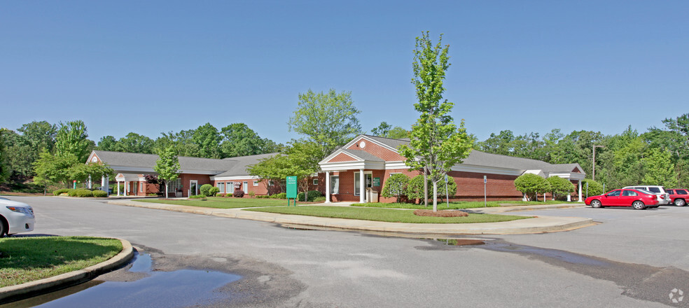
HOA Management in Chapin, SC
William Douglas Management is a leader in customer service — the experience and expertise that your association needs and deserves!
Cramerton, is a town centrally located in eastern Gaston County
Chapin or the Town of Chapin, South Carolina, is located in northern Lexington County. The town is named after the original landowner of the area, Martin Chapin(1821 – 1894). The Town of Chapin is the quintessential railroad town. Its genesis was being in the path of the Columbia, Newberry, and Laurens Railroad that laid tracks through the future Chapin community between 1890 and 1891. Chapin is like the hundreds of towns and cities across the United States that were established from 1830 through 1900 as a result of the railroad arriving in their area.
Chapin’s town nickname is “The Capital of Lake Murray.”
Chapin’s Location – Latitude: 34°09′56.77″N, Longitude: 81°21′03.00″W.
Chapin’s zip code is 29036.
Telephone area codes for Chapin are 803 and 839.
Chapin’s population per the 2010 U.S. Census was 1,445. The estimated population for 2019 was 1,633, per the U.S. Census Bureau. The total area of Chapin is Irmo’s total area is 1.99 square miles, per the 2010 U.S. Census Bureau.
Chapin falls within the Columbia Metropolitan Statistical Area (MSA). The Columbia MSA is comprised of the six counties of Calhoun, Fairfield, Kershaw, Lexington, Richland, and Saluda. The estimated population of the Columbia MSA as of 2020 was 847,397. The Greenville MSA is the largest MSA in South Carolina, with the Columbia MSA being the second largest. As measured by population, in the United States, the Columbia Metropolitan Statistical Area is the 69th largest.
Chapin and Area: A Brief Historical Overview
The first European documented record of the future Lexington County comes from the expedition of Spanish explorer Hernando de Soto’s expedition in 1540. The chronicling of this expedition is found within a number of original first-person works. The semi-anonymous work of a Gentleman of Elvas, a Portuguese knight, who was a member of the expedition, was the first to publish his work in 1557. Luys Hernández de Biedma, Spanish King Charles I’s factor (an accountant), compiled a detailed report of the expedition. This report was filed in King Charles I’s court in 1544, and the original report is still held in Spain’s national archives.
Hernando de Soto’s personal secretary, Rodrigo Ranjel, complied a journal of the expedition. His journal was used as a source document by Gonzalo Fernández de Oviedo y Valdés in writing La historia general y natural de las Indias. The aspects of Valdés’ work based on Ranjel’s journal were first published in 1851. Regrettably, Ranjel’s expedition’s original journal has been lost to history.
De Soto’s expedition began in 1539 and was the first European-led expedition that penetrated deep into the interior of what would eventually become the United States. The expedition was in search of a land route to China and treasure. This expedition became infamous for the utter brutality exhibited upon many of the unfortunate Native Americans they encountered. The de Soto expedition is also noted as the first to expose Native Americans to European diseases that ultimately devastated their populations.
The de Soto expedition entered South Carolina in search of the Cofitachequi chiefdom looking for treasure. The Cofitachequi’s territory was reportedly the area between the Santee, Wateree, and Pee Dee rivers in present-day northeastern South Carolina. On the way to the Cofitachequi chiefdom, de Soto’s expedition arrived in April of 1540 at the confluence of the Saluda and Broad rivers, where they merge to create the Congaree River.
De Soto came upon a large Native American village on the west side of the Congaree River or one of the tributaries of the Congaree River. This would become the future Lexington County. This village is thought to have been a Congaree Indian village. The expedition left and traveled on to the Cofitachequi chiefdom town of Talimeco. Talimeco is believed to have been near present-day Camden, South Carolina.
The Congaree Indian territory is generally considered the present-day Lexington and Richland counties areas. The confluence of the Broad and Saluda rivers is a fertile area for farming, hunting, and fishing. Archeological evidence indicates that the Congaree Indians were very prosperous along the rivers before Europeans arrived. In James Mooney’s “The Aboriginal Population of America North of Mexico,” published by the Smithsonian Institute in 1928, he estimated the Congaree population to be 800 in the year 1600.
By 1700, the Congaree Indian population had been devastated by smallpox. English explorer John Lawson in his expedition to the Carolina backcountry in 1701, chronicled his interactions with the Congaree in A New Voyage to Carolina. Published in 1709, his book is very descriptive of the Congaree people. Lawson spells Congaree in his book as “Congeree.” From that work, “The Congerees are kind and affable to the English, the Queen being very kind, giving us what Rarities her Cabin afforded…These are a very comely Sort of Indians…Difference in the Proportion and Beauty…” Lawson writes in his book that the Congaree people were small in number because of smallpox and intertribal conflicts.
Colonel John Barnwell, a famous English colonist and Indian fighter was tasked with raising a force of Native Americans to travel to North Carolina and fight in what became known as the Tuscarora War of 1711. Barnwell raised 30 white militia officers and 500 Indians, some of these Indians were Congaree Indians. The Barnwell force arrived in North Carolina and was successful in their campaign against the Tuscarora Indians, gaining a peace treaty. Barnwell performed a census in 1715 of the surviving Congaree Indians and calculated the remaining Congaree all living in one village totaled only 22 men, 70 women, and children. The Congaree Indians’ involvement in the Yamasee War of 1715 led their tribe to become extinct.
Settlers to Lexington County from around 1720 to 1750 were mostly German-speaking Swiss and some German Lutherans. Around the 1750s, Scots-Irish settlers began arriving. The majority of the early settlers were homesteading small farms and were subsistence farmers. After the American Revolutionary, subsistence farming and small farms began to be replaced by larger farms and cash crops. This radical development was due to technical advances in farming, but most impactful was the invention cotton gin in 1793. Cotton cultivation became the cash crop of the region for many farmers, leading to larger, more efficient farms.
Lexington County was formed after the American Revolution in 1785. In the 1800s, cities, and towns experienced precipitous population growth. While Lexington Court House (Now known as the town of Lexington.) to the southeast became the county seat for Lexington County in 1820, the county was still considered a rural area. Columbia in Richland County to the southeast had just 3,000 in 1830. The population of the future Chapin is not exactly known during this time period, but again it was a rural area.
The arrival of the Columbia, Newberry, and Laurens Railroad in 1890 was the genesis of Chapin.
Martin Chapin and his wife Laura Ann Benjamin Chapin(1829–1919) accumulated 4,218 acres in the future Chapin area; much of the land would be taken when Lake Murray was built in the 1920s. They constructed a hotel along the Columbia, Newberry, and Laurens Railroad lines. The railroad stop was a beacon for area farmers and businessmen. The railroad provided for a more efficient and economical way to transport their products to other markets. In the Chapin area around this time, cotton cultivation and harvesting timber were leading economic drivers.
The South Carolina General Assembly granted the Columbia, Newberry, & Laurens Railroad a charter in 1886. Construction of the rail line began in 1890 and was stopped short of Laurens in July of 1891. At this point, the rail line reached from Columbia to Dover Junction (Clinton, South Carolina), totaling 63.5 miles of rail. Only reaching Laurens in 1896 when the Laurens Railroad was merged into the Columbia, Newberry, & Laurens Railroad.
Passenger trains were operated daily from Columbia to Laurens through Chapin from 1890 until 1952 until the service was discontinued. The passenger train locomotives for this entire period were all steam-powered. The Columbia, Newberry, & Laurens Railroad, contrasting many early railroads, was profitable for most of its operating life. This operational success was primarily due to the strong businesses and industries along their rail route. In the 1950s, when the South Carolina Electric & Gas Company steam-powered electric generating plant on Lake Murray came online, the railroad’s revenue was drastically increased. The Atlantic Coast Line Railroad purchased the Columbia, Newberry, & Laurens Railroad in 1924. However, the Columbia, Newberry, & Laurens Railroad was such a well-run operation it continued as a separate company until 1984, when it was rolled into the CSX Railroad.
Construction on what would become Lake Murray began in 1927 on the Saluda River. Around 100,000 acres of land was acquired in the 1920s to begin construction of the lake and dam. The population where the lake was coming in and around a dozen communities had to be moved, along with six schools, three churches, and around 193 cemeteries. The lake began filling with water on August 31, 1929, and construction of the lake and dam was considered complete in 1930. Today, Lake Murray covers approximately 50,000 acres of land.
While today the economic activity derived from Lake Murray is probably the most impactful for Chapin of all other economic factors, however, this is a relatively recent development. The population in the 1930 U.S. Census indicated a population increase of 429 from 264 that was calculated in the 1920 U.S. Census. This population increase, probably due to the construction of Lake Murray, dropped to 311 in the 1940 U.S. Census calculations. The population of Chapin remained under 400 through the 1990 U.S. Census. However, the population and residential developments in the surrounding Chapin area are not represented within the U.S. Census. The last thirty years as Lake Murray developed, along with the construction of a better road system, compounded by urban sprawl from other cities and towns, has impacted Chapin’s economic growth.
In the 20th century, growth besides the construction of Lake Murray can be measured in smaller but still important events. In the 1950s, Chapin saw its first post office building constructed, along with a new telephone service for the town. In the 1960s, Interstate 26 was completed and improved the transportation needs of the community. A volunteer fire department was formed in 1965, and the town purchased an ambulance in 1966.
Copyright © 2021 William Douglas Management, Inc.
Need Association Management?
Contact Us
How to Start
The Process of Working With Us


REQUEST A PROPOSAL
Request a proposal online or call us directly.


WE WILL REVIEW YOUR CASE
Our team of highly trained professionals will review your case.


RECEIVE A CUSTOM TAILORED PLAN
We will create a customized management plan for your community.


SEAMLESS TRANSITION
We will implement a seamless management transition and integrate our tech.


SIT BACK & RELAX
Enjoy better, affordable and a more reliable, hassle-free management system.
OUR REVIEWS
What Our Clients Say

We never lived in an area where they had HOA’s or property management companies before, so this is all new to us. Our experience with William Douglas PMC is kind of limited, but in recent months we have dealt with it more because our subdivision is being turned over to what will be our HOA very soon. I’ve had questions and each time I’ve contacted WDPMC I have received a timely response.

As Treasurer of our HOA, it’s a pleasure to work with William Douglas Property Management. They make our life so much easier!

This company has helped save our neighborhood.