
HOA Management in Easley, SC
William Douglas Management is a leader in customer service — the experience and expertise that your association needs and deserves!
Pickens County, with a small area within Anderson County
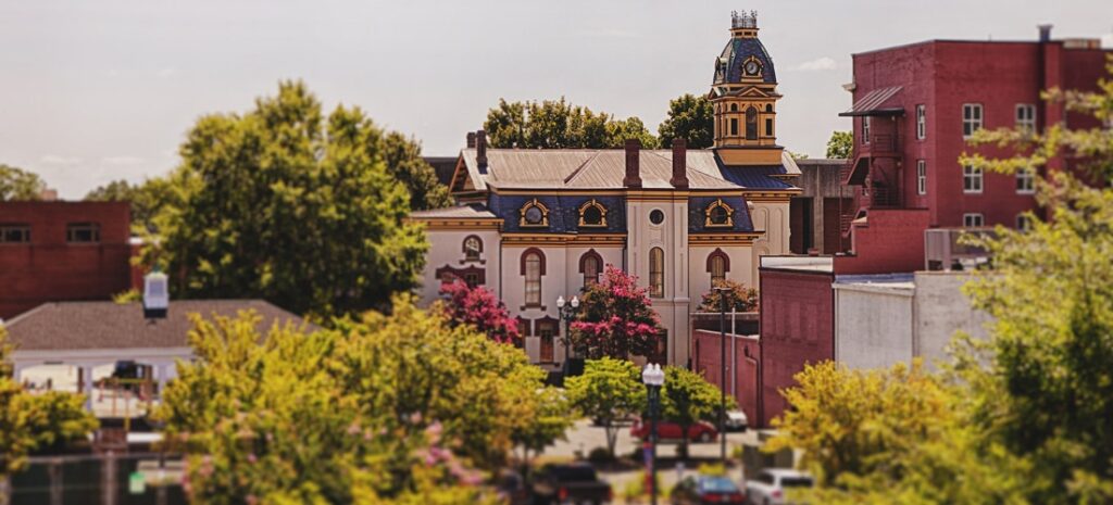
Easley, South Carolina, is a city primarily in Pickens County, with a small area within Anderson County. The city of Easley had a population as of the 2010 U.S. Census of 19,993. The 2019 U.S. Census population estimate was 21,364. Easley is around 12 miles from downtown Greenville. The land area of Easley is 12.26 square miles per the U.S. Census Bureau. Easley standard delivery zip codes are 29640 and 29642. The Easley post office box zip code is 29641. The area code for Easley is 864.
The origin of the city’s namesake “Easley” was a prominent citizen of the area, William King Easley (1825 – 1872).
Per the 2010 U.S. Census for Easley
Population per 2010 Census: 19,993
Male population: 48.0%
Female population: 52.0%
Population under 18 years: 20.6%
Bachelor’s degree or higher 2015-2019: 25.3%
Population 65 years & over: 20.0%
Median home value 2015-2019: $159,800
Total households 2015-2019: 8,738
High school graduate or higher 2015-2019: 85.2%
As of the 2012 U.S. Census, there were 2,743 firms or businesses within Easley
Historical population per U.S. Census of Easley, South Carolina
Census Pop. %±
1880 327 —
1890 421 28.7%
1900 903 114.5%
1910 2,983 230.3%
1920 3,568 19.6%
1930 4,886 36.9%
1940 5,183 6.1%
1950 6,316 21.9%
1960 8,283 31.1%
1970 11,175 34.9%
1980 14,264 27.6%
1990 15,195 6.5%
2000 17,754 16.8%
2010 19,993 12.6%
2019 21,364 (est.) 6.9%
—–
The English Crown established the first permanent settlement in South Carolina in 1670, Charles Town (Charleston). At first, the coastal areas of South Carolina were colonized. At the turn of the 18th century, the South Carolina backcountry was being explored more deeply, and settlers were slowly colonizing certain areas. This colonization of the backcountry accelerated around the mid-18th century.
With the colonization of the backcountry, issues of law and order were centralized back in Charles Town. Thus, necessitating that all legal matters be dealt with in Charles Town. This made the rule of law burdensome to those outside of Chares Town.
To remedy this problem, the colonial governor in 1769 established seven judicial districts in South Carolina. These judicial districts covered almost all of present-day South Carolina except the western tip of the state. This western tip was Cherokee territory. This territory today consists of Anderson, Greenville, Oconee, and Pickens counties. The Cherokee people would be required to surrender this territory as a result of the Native American uprising during the American Revolution.
The Cherokee had been dealing with trespassing settlers long before the American Revolutionary War. However, the war brought this problem to a head. The war became the tipping point for the Cherokee, which resulted in a bloody conflict that would become known as the Cherokee War of 1776. The Cherokee and other Indian tribes aligned with the British during the American Revolution against the Patriots.
In July of 1776, Cherokee war parties along with other allying Indians began ferocious raids throughout South Carolina and neighboring states. These raids were focused on individual settlers and lone settlements to devastating effect. Those settlers not killed outright were many times subject to torture, mutilation, and then beaten to death. Once dead, then they were scalped. The Indian raiding parties would then burn the settler’s home and crops and then slaughter all the livestock.
As can be imagined, these raids panicked and angered the population, with many of the population fleeing to frontier forts for protection and others seeking retribution. In response to these Indian raids, state militias and regular Continental troops commenced a punitive campaign against the Cherokee and their Native American allies. The South Carolina, North Carolina, and Virginia state militias, comprised of 6,000 men, launched a three-prong retaliatory raid against the Cherokee and their Native American allies. A great many of these militiamen began these raids intent on revenge for the brutal murders of family, friends, and neighbors. Because of the brutality of these initial Indian raids and the resulting public sentiment, numerous prominent leaders of the time, including Thomas Jefferson, Patrick Henry, and John Hancock, were demanding the elimination of the Cherokee Nation.
Rightly or wrongly, many Patriots believed the extreme brutality of the Indian raids was at the direction of the British. It was believed these Indian raids were attempts by the British to erode Patriot support among the population. Whereas the Cherokee and other Native American tribes reportedly felt they were well within the norms of their culture to defend their territory from trespassers. The determination of any direct involvement of the British in the magnitude of the brutality in the raids is not known. Yet, the British advised that the Cherokee and other tribes had the right to remove trespassers from their lands.

The state militia’s retaliatory raid on the Cherokee Nation and other Native American tribes was brutal and, in most estimates, a disproportional response in comparison to the initial Indian raids. Over fifty Indian towns or villages were burned, along with any unharvested crops. This was shelter and food the Indians were going to need for the coming winter. The initial and eventual death tolls for all parties in the conflict are unknown. However, it is believed to be in the hundreds.
Except for a limited number of Indian holdouts led by Cherokee war chief (skiagusta) Dragging Canoe (c. 1738 – 1792), the Cherokee War of 1776 was essentially over by the beginning of 1777. That year, the Cherokee people, with no other options, signed the Treaty of DeWitt’s Corner with representatives of the state of South Carolina. As one of the conditions of this treaty, the Cherokee were forced to relinquish their claim to most of their territorial land in the upstate of South Carolina. This relinquished Cherokee land included most of present-day Anderson, Greenville, Oconee, and Pickens counties.
Pickens County has a land area of 496.41 square miles, and as of the 2010 U.S. Census, a population of 119,224. The origins of present-day Pickens County can be traced back to the Pickens District, which was formed in 1826. (All South Carolina counties were renamed as districts in 1800. This district moniker reverted to county In 1868.) The large size of Pickens and the location of the courthouse led to Pickens being roughly divided in two in 1868. This new configuration formed Oconee County and a reduced in size Pickens County to its present-day county lines.
Pickens County was named in recognition of Andrew Pickens (1739 – 1817). Pickens was a South Carolina Militia general during the American Revolutionary War. He was a militia leader during the Cherokee War of 1776. Pickens was in command of the Patriot forces at the Battle of Kettle Creek (February 14, 1779), which was the first Patriot victory in Georgia during the Revolution. Pickens demonstrated a significant leadership contribution at the strategically decisive Battle of Cowpens (January 17, 1781). Cowpens was strategically decisive because of this defeat, along with the British defeat at Kings Mountain (October 7, 1780). British General Cornwallis elected to take a strategy of pursuing Continental Army General Nathan Greene’s forces. This strategy with Greene’s forces ultimately led to the British surrender at Yorktown on October 19, 1781.
With the colonization of the backcountry, issues of law and order were centralized back in Charles Town. Thus, necessitating that all legal matters be dealt with in Charles Town. This made the rule of law burdensome to those outside of Chares Town.
To remedy this problem, the colonial governor in 1769 established seven judicial districts in South Carolina. These judicial districts covered almost all of present-day South Carolina except the western tip of the state. This western tip was Cherokee territory. This territory today consists of Anderson, Greenville, Oconee, and Pickens counties. The Cherokee people would be required to surrender this territory as a result of the Native American uprising during the American Revolution.
The Cherokee had been dealing with trespassing settlers long before the American Revolutionary War. However, the war brought this problem to a head. The war became the tipping point for the Cherokee, which resulted in a bloody conflict that would become known as the Cherokee War of 1776. The Cherokee and other Indian tribes aligned with the British during the American Revolution against the Patriots.
To fully understand where the city of Easley originated, the reader must start two miles away, in a town that would become Pickensville. In 1791 a town called Rockville was planned with laid-out streets and lots as the new location of the Washington District’s (County) new courthouse and district (county) seat. Charles Coatsworth Pinckney donated the 66-acre site for the new town. There was a new courthouse, jail, a tavern, a hotel, and assorted other structures built to address the needs of the townspeople. A small town arose from this Rockville genesis, and in 1792, the new town was officially named by the South Carolina legislator as Pickensville in honor of Militia General Andrew Pickens. This became the first town established in present-day Pickens County
Pickensville was a town of importance to the frontier population. The town gained a reputation for being dangerous, with murders and other lesser crimes being committed on a frequent basis. The courts had regular public hangings that drew large crowds of spectators.
By all indications, Pickensville was set to become a larger and larger town. However, this was not to be the case when in 1798, the Washington District was divided in two to create the Greenville District and Pendleton District. Pickensville was left as the district seat for Pendleton. In 1826, the Pendleton District was divided to form Anderson and Pickens counties. The county seat and the court system moved to a more centralized location in the new county. Pickensville slowly declined as the town moved into the 19th century.
The real decline of Pickensville occurred when the Atlanta & Richmond Air Line Railway laid rail lines two miles away through Robert Elliot Holcombe’s land. Holcombe, to entice the railroad to come through his property, paid for and constructed the train depot. Legend has it that this community was first known as the Holcombetown or Holcombe Town community. Another legend states that Robert Holcombe thought Easley sounded better as a name for the town. One aspect about the naming that is indisputable is the city moniker “Easley,” which originated from William King Easley.
William King Easley (1825 – 1872), an attorney, politician, and Confederate War veteran, was born in George’s Creek, located near present-day Easley. W.K. Easley was instrumental in encouraging Robert Elliot Holcombe to buy stock in the railroad, donate his land, and build the train depot. W.K. Easley worked with the railroad and was influential in persuading the Charlotte Airline Railroad to lay their tracks through what would become Easley.
The city of Easley was founded and incorporated in 1874, around the new rail line and depot. The majority of the land around the rail line was owned by Robert Elliot Holcombe (1823 – 1893). Holcombe is considered to be the founder of Easley or the cofounder if you include W.K. Easley’s critical efforts. Holcombe was a multifaceted individual who did a great deal and accomplished a great deal in his 70 years of life. Not only did he own the general store that would be adjacent to the new rail line, but he was involved in a vast array of professions and endeavors at one time or the other. Holcombe is noted as being a merchant, depot agent, telegraph operator, sawmill owner, doctor, lawyer, magistrate, postmaster, farmer, newspaper publisher, financier, philanthropist, county commissioner, state legislator, and the first mayor of Easley. He also found time to be the father of eleven children.
This is where clarification around Easily and what happened to Pickensville is needed. A post office was opened in Pickensville on April 1, 1795. On October 11, 1875, the U.S. Post Office officially changed the name of Pickensville’s post office to the Easley post office. This has led to a misconception that Pickensville was the city’s original name, and the name was changed to Easley. This is not correct; both were neighboring cities but separate. To reemphasize this point, one only needs to look at the annexation vote on November 27, 1962, when Easley annexed the Forest Acres area that once was where Pickensville stood.
The arrival of the railroad spurred economic growth for the entire Easley area. The railroad gave farmers access to new markets. Even more importantly, it allowed farmers the opportunity to grow more profitable crops to ship to other markets. Cotton cultivation in the area and the railroad ushered in textile manufacturing in Easley and the surrounding areas. From Easley’s founding in 1874 and for almost the next one hundred years, textiles played a major economic role in Easley and the surrounding area.
The first manufacturing business in Easley, a cotton gin, was reportedly the Easley Oil Mill. It was established in 1889. The following year in 1890, the first cotton mill was constructed, the Easley Cotton Mill. The Glenwood Mill was completed in 1902. The Alice Lace Works was established in 1970. All of these operations were a major presence in the city. The latter three mills being major employers for years to come.
Into the 20th century, textile manufacturing continued to be attracted to Easley. In 1953, the Easley Textile Company, which later became Swirl Inc., came to the city and became a major employer. Saco Lowell, a producer of yarn equipment, constructed a manufacturing plant in Easley in 1956. As the textile economy waned, Easley was successful at attracting a more diversified economic base. Fluid Controls was purchased by Danfoss Fluid, a maker of motors and pumps, and became a major employer.
The development of U.S. Highway 123 has turned Easley into a bedroom community for other communities. Downtown Greenville is around 12 miles drive, and Clemson is only 18 miles drive from Easley. Just as the railroad brought population and commerce to Easley in the 19th century, highways have achieved this in the 20th and 21st centuries.
The first church in what would become Easley was Olivet Methodist Church. This church was founded in 1846 on a hill near the rail lines, where the West View Cemetery is in present-day Easley. The church stood at that location until 1930. Olivet Methodist Church changed names to the Easley First Methodist and is now located on West 1st Avenue in Easley.
Need Association Management?
Contact Us
How to Start
The Process of Working With Us


REQUEST A PROPOSAL
Request a proposal online or call us directly.


WE WILL REVIEW YOUR CASE
Our team of highly trained professionals will review your case.


RECEIVE A CUSTOM TAILORED PLAN
We will create a customized management plan for your community.


SEAMLESS TRANSITION
We will implement a seamless management transition and integrate our tech.


SIT BACK & RELAX
Enjoy better, affordable and a more reliable, hassle-free management system.
OUR REVIEWS
What Our Clients Say

We never lived in an area where they had HOA’s or property management companies before, so this is all new to us. Our experience with William Douglas PMC is kind of limited, but in recent months we have dealt with it more because our subdivision is being turned over to what will be our HOA very soon. I’ve had questions and each time I’ve contacted WDPMC I have received a timely response.

As Treasurer of our HOA, it’s a pleasure to work with William Douglas Property Management. They make our life so much easier!

This company has helped save our neighborhood.