
HOA MANAGEMENT flat rock, nc
William Douglas Management is a leader in customer service — the experience and expertise that your association needs and deserves!
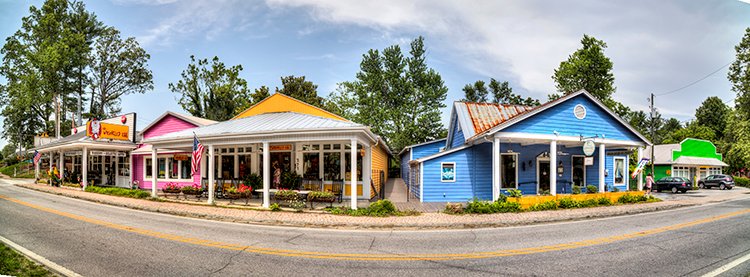
East Flat Rock is an unincorporated area in Henderson County, Nc
William Douglas Property Management offers HOA Management and Association Management services in East Flat Rock, NC
East Flat Rock, N.C. Facts & Information
East Flat Rock is an unincorporated area in Henderson County, North Carolina. Since it is unincorporated, the United States Census Bureau classifies East Flat Rock as a census-designated place (CDP). The census-designated place or CDP for East Flat Rock, as established by the United States Census Bureau, is a total area of 4.3 square miles. Of these 4.3 square miles, 4.29 square miles is land, and the remaining 0.01 square miles consists of water.
East Flat Rock being unincorporated, there are no legally established or defined city limits other than what has been established by the United States Census Bureau. The area recognized as the census-designated places may or may not be consistent with the traditional or local perception of the area or community defined as the CDP. There are a number of different reasons why the Census Bureau establishes a census-designated place. However, they are established in most instances because of a population concentration, such as what is found within East Flat Rock CDP.
Key Points About East Flat Rock
East Flat Rock’s population, per the 2020 United States Census, was calculated to be 5,757. This was a population growth rate increase of 13.2% since the 2010 United States Census.
East Flat Rock’s population, per the 2010 United States Census, was calculated to be 4,995.
Per Google Earth Location/Coordinates of East Flat Rock – Latitude: 35°16′48.49″ N, Longitude: 82°25′19.43″ W
The Elevation above sea level for East Flat Rock’s is 2,209 feet per Google Earth for the location/coordinates noted above.
Females make up 50.2% of the East Flat Rock census-designated place population per the United States Census Bureau.
Males make up 49.8% of the East Flat Rock census-designated place population per the United States Census Bureau.
Coordinates of Cramerton per Google Earth – Latitude: 35°14′09.51″N, Longitude: 81°04′18.24″ W
East Flat Rock’s population per square mile was 1,164.1 per the 2010 United States Census.
The zipcode for East Flat Rock is 28726.
The telephone area code for East Flat Rock is 828.
As of 2012, per the United States Census, East Flat Rock had 436 total businesses or firms within the census-designated place.
The land area of the East Flat Rock census-designated place per the 2010 United States Census was 4.29 square miles.
Per the United States Census Bureau, 2015=2019, East Flat Rock’s median household income was $46,394 in 2019 dollars.
Per the United States Census Bureau, 2015-2019, there were 2,057 households within the East Flat Rock census-designated place.
Per the United States Census Bureau, 2015-2019, there were 2.70 persons per household within the East Flat Rock census-designated place.
Per the United States Census 2015-2019, the median value of an owner-occupied housing unit within the East Flat Rock census-designated place was $155,600.
It has been calculated that 77.5% of the East Flat Rock census-designated place population who are 25 years of age or older are high school graduates per the United States Census Bureau.
It has been calculated that 13.3% of East Flat Rock census-designated place population who are 25 years of age or older hold a bachelor’s degree or have obtained a higher level of education per the United States Census Bureau.
The East Flat Rock census-designated place is situated in the mountainous region of western North Carolina. The annual climate would be considered moderate.
The East Flat Rock census-designated place is within the Asheville, North Carolina Metropolitan Statistical Area (MSA). The Asheville, North Carolina Metropolitan Statistical Area (MSA) comprises Buncombe, Haywood, Henderson, Madison, and Transylvania counties. The population of the MSA was 469,015 as of the 2020 United States Census. The population of the MSA was 424,858 as of the 2010 United States Census. This is a 9.4% population growth rate between censuses.
Measured by population, the Asheville, North Carolina Metropolitan Statistical Area (MSA) is the 120th largest MSA in the United States. In North Carolina, the Asheville, North Carolina Metropolitan Statistical Area (MSA), based on population, is the fourth largest MSA behind the Charlotte-Concord-Gastonia NC-SC MSA, the Raleigh-Cary, NC MSA, and the Greensboro-High Point, NC MSA.
Interesting Points about East Flat Rock census-designated place
The Society of Necessity was begun in East Flat Rock in 1885 by area African American churches. The Society began helping its members post-Civil War with small loans to help during difficult economic times. The Society would also help with groceries, heating fuel, and doctor visits.
General Electric opened its East Flat Rock plant on Spartanburg Highway in 1955. Which at one time was Henderson County’s largest employer with 1,100 employees. General Electric sold the plant in 2019 to American Industrial Partners, a New York-based private equity firm. The plant currently has around 430 employees and manufacturers of outdoor lighting.
Henderson County, North Carolina
Henderson County was created in 1838 from the southern portion of Buncombe County. The county is named for Chief Justice of the North Carolina Supreme Court, Leonard Henderson (October 6, 1772 – August 13, 1833).
Polk County was created from portions of both Henderson County and Rutherford County in 1855. Transylvania County was created from portions of Henderson County and Jackson County in 1861, reducing the size of Henderson County even further.
The first United States Census for Henderson County was 1840, and the population was calculated at 5,129. The 2010 United States Census for Henderson County was calculated at 106,740. The 2020 United States Census for Henderson County was calculated at 116,281. This was a population increase of 8.2% between the 2010 and 2020 census.
It has been calculated that 89.9% of the Henderson County census-designated place population who are 25 years of age or older are high school graduates per the United States Census Bureau.
It has been calculated that 31.8% of Henderson County’s census-designated place population who are 25 years of age or older hold a bachelor’s degree or have obtained a higher level of education per the United States Census Bureau.
Henderson County’s land area per the United States Census Bureau per 2010 was 373.07 square miles.
Henderson County’s population per square mile is 286.1 per the United States Census Bureau per 2010.
Need Association Management?
Contact Us
How to Start
The Process of Working With Us


REQUEST A PROPOSAL
Request a proposal online or call us directly.


WE WILL REVIEW YOUR CASE
Our team of highly trained professionals will review your case.


RECEIVE A CUSTOM TAILORED PLAN
We will create a customized management plan for your community.


SEAMLESS TRANSITION
We will implement a seamless management transition and integrate our tech.


SIT BACK & RELAX
Enjoy better, affordable and a more reliable, hassle-free management system.
OUR REVIEWS
What Our Clients Say

We never lived in an area where they had HOA’s or property management companies before, so this is all new to us. Our experience with William Douglas PMC is kind of limited, but in recent months we have dealt with it more because our subdivision is being turned over to what will be our HOA very soon. I’ve had questions and each time I’ve contacted WDPMC I have received a timely response.

As Treasurer of our HOA, it’s a pleasure to work with William Douglas Property Management. They make our life so much easier!

This company has helped save our neighborhood.