
HOA Management in Greer, SC
William Douglas Property Management offers HOA Management and Association Management services in Greer, SC
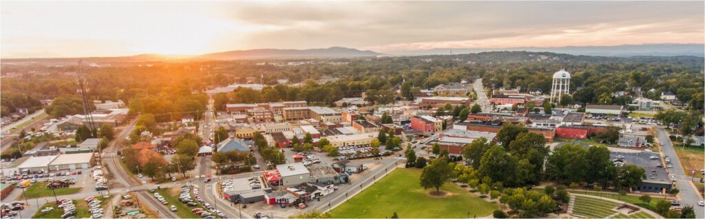
Greer, S.C. facts & Information
Greer, is a municipality located in both Greenville and Spartanburg counties As of 2021, Greer is the 14th largest municipality within South Carolina. Greer is chartered as a city by the state of South Carolina.
The Greenville-Spartanburg International Airport (GSP), which serves the Upstate region of South Carolina, is just south of Greer. The airport first opened on October 15, 1962. After the Charleston International Airport, the Greenville-Spartanburg International Airport is the second-busiest airport in South Carolina, with around 2.61 million passengers in 2019. The asphalt and concrete runways are 11,001 feet long.
Greer is home to the North American BMW manufacturing facility, even though it is commonly known as the Spartanburg manufacturing plant. The BMW facility employs around 9,000 people, along with around 12,000 people employed by BMW suppliers. The facility manufacturers around 1,500 vehicles per day. The models produced included the X3, X4, X5, X6, and X7 SUV models.
In 1992, BMW announced that it would construct a 1,150-acre automobile manufacturing plant in Greer, South Carolina. The manufacturing plant opened in 1994 to great fanfare. BMW announced in 2010 that it would expand operations to produce 240,000 automobiles annually and spend 750 million dollars to accomplish this expansion. This expansion made the BMW Spartanburg manufacturing plant the largest in the United States with many employees.
One of two of South Carolina’s Inland Ports is located in Greer, Inland Port Greer. Inland Port Greer opened in November of 2013. Inland Port Greer travels over 200 miles connecting the Port of Charleston. This connection is via an overnight rail service provided by Norfolk Southern. The Inland Port Greer processes containerized goods to and from the I-85 corridor, the fastest-growing area of the southeastern United States.
A Brief Historic Overview of Greer
The first recorded inhabitants of the future Greer area and the entire section of South Carolina were the Cherokee Indians. The future Greer was part of the Cherokee people’s vast hunting ground. During the American Revolution, the Cherokee Indians sided with the British. As a result, the Cherokee territory was taken from them and added to the state of South Carolina in 1777. It was open, for the first time to “legalized” settlement by settlers of European origin.
Greer’s namesake was James Manning Greer (08/07/1827 – 07/02/1900). He was the great-grandson of John Greer Sr., who in the 1750s surveyed and took possession of land in Laurens County. The Greer family initially homesteaded in the area of Duncans Creek and the Enoree River. This is the vicinity of the historic Duncan’s Creek Presbyterian Church (Latitude: 34°31′17.08″ N, Longitude: 81°48′21.50″ W) northeast of Clinton, South Carolina. John Greer Sr.’s descendants are spread throughout the general area and region.
James Manning Greer and his family settled his family around ten miles northeast of Greenville, which ultimately became known as Greer’s Station. This origin traces its roots to the Atlanta & Richmond Air Line Railway, which was incorporated in 1870, and was operational in 1873. The Atlanta & Richmond Air Line Railway constructed a depot on land that was once owned by James Manning Greer and thus, the name Greer’s Depot was born in 1873. The depot’s name was changed by the railroad to just “Greer” in 1901.
The new depot was of Victorian design with a cupola, slate roof and constructed with red brick. It was demolished in 1976 and was located between Trade and Depot streets adjacent to the rail line. The new depot also housed the town’s first post office.
The future City of Greer was incorporated in 1876 as the Town of Greer’s. The apostrophe “s” attached to Greer was included and sometimes not included in newspaper accounts of the town. The apostrophe “s” and the plural “Greers” slowly fell out of use through the years. In the 1970s, the name was formally changed to the City of Greer.
With the arrival of the railroad in 1873, it immediately became the major economic driver for the entire area. Agricultural enterprises and supporting businesses slowly developed around Greer’s Depot. Cotton and peaches were the primary crops grown in the area at the time. The railroad helped facilitate the cultivation of these two crops by opening faraway markets to these two cash crops.
A downtown developed along the rail line from the Greer’s Depot with these businesses. Greer’s first bank, the Bank of Greer’s, was funded and opened in 1900. Around the turn of the 20th century, textile manufacturing in the region began to play a larger part in the economy. The railroad played a large part in the development of textiles in the region as well. A second rail line was laid down through Greer in 1914. Greer developed into a major textile center with four major mills Victor, Franklin, Apalache, and Greer mills. As the textile mills continued to be opened in Greer, the population increased to keep pace with the employment demands of these textile mills.
Greer Historical population
CensusPop
1880 97
1890 320
1900 648
1910 1,673
1920 2,292
1930 2,419
1940 2,940
1950 5,050
1960 8,967
1970 10,642
2000 16,843
1990 10,322
2010 25,515
2020 35,308
Greer Data and other Interesting Facts
Greer had 11,531 households (2015-2019) per the United States Census Bureau.
Per the United States Census Bureau (2015-2019), the percentage of population 25 years of age or older high school graduate in Greer: 85.7%
Per the United States Census Bureau (2015-2019), the percentage of population 25 years of age or older bachelor’s degree or higher in Greer: 32.5%
Per Google Earth Location or Coordinates of Greer – Latitude: 34°56′19.56″ N, Longitude: 82°13′37.40″ W
Greer’s Elevation above sea level is 1,016 feet per Google Earth for the coordinates noted above.
Per the United States Census Bureau, as of 2012, Greer had 2,580 total businesses or firms within the census-designated place.
As of 2010, the land area of Greer, per the United States Census Bureau, was 20.64 square miles.
The owner-occupied housing unit rate in Greer per United States Census Bureau (2015-2019) was 62.3%.
Greer’s population per square mile in 2010 was 1,236.4.
Need Association Management?
Contact Us
How to Start
The Process of Working With Us


REQUEST A PROPOSAL
Request a proposal online or call us directly.


WE WILL REVIEW YOUR CASE
Our team of highly trained professionals will review your case.


RECEIVE A CUSTOM TAILORED PLAN
We will create a customized management plan for your community.


SEAMLESS TRANSITION
We will implement a seamless management transition and integrate our tech.


SIT BACK & RELAX
Enjoy better, affordable and a more reliable, hassle-free management system.
OUR REVIEWS
What Our Clients Say

We never lived in an area where they had HOA’s or property management companies before, so this is all new to us. Our experience with William Douglas PMC is kind of limited, but in recent months we have dealt with it more because our subdivision is being turned over to what will be our HOA very soon. I’ve had questions and each time I’ve contacted WDPMC I have received a timely response.

As Treasurer of our HOA, it’s a pleasure to work with William Douglas Property Management. They make our life so much easier!

This company has helped save our neighborhood.