
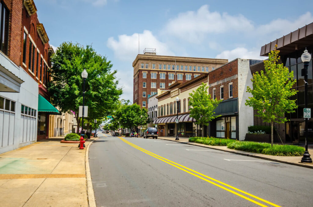
HOA Management in Lowell, NC
Lowell is a city centrally located in eastern Gaston County, North Carolina. Lowell is located in the Piedmont region of North Carolina. The annual climate is considered moderate. Lowell is situated north of major thoroughfares Interstate 85 and U.S. Highway 74. In North Carolina, Lowell is the 183rd largest in the state.
Lowell’s population was calculated as 3,654 per the 2020 United States Census
Lowell’s population was calculated as 3,526 per the 2010 United States Census.
The first United States Census for Lowell was the 1880 Census, and the population was calculated to be 35.
There was a mill on the South Fork of the Catawba River that was the genesis of a small settlement where Lowell is today. The small settlement was dated to around 1848 and was named Woodlawn Mill.
When the Atlanta & Richmond Air Line Railway arrived in 1873, they named their station the “Wright Station.” This name was derived from a nearby farmer William Wright. The railroad changed the train stop’s name to Lowell in December of 1879.
The first post office was established in what would become Lowell in 1873. The post office was known as the “Pin Hook Post Office.” In newspaper accounts, it was also referred to as the “Pin Hook Depot.”
Lowell was named after Lowell, Massachusetts. The aspiration was that it would become the textile center of the south.
Lowell was incorporated by the North Carolina General Assembly on February 10, 1879.
The land area of Lowell is 2.72 square miles.
City Motto: “Live – Love – Lowell”
Per Google Earth Coordinates of Lowell – Latitude: 35°16′04.50″N, Longitude: 81°06′10.28″ W
Lowell is one of fifteen municipalities within Gaston County and is the fifth smallest in population. Nearby Gastonia has the largest population per the 2020 United States Census with 80,411 inhabitants. The origin of Lowell begins with the creation of Gaston County. Gaston County was created in 1846 from the southern part of mega-sized Lincoln County, which was approximately 1,200 square miles. Gaston County was established with borders encompassing 364 square miles.
Gaston County was named in honor of William J. Gaston (1778 – 1844). W.J. Gaston was a prominent politician and jurist of the early 1800s in North Carolina. He was a successful United States Congressman and leading member of the North Carolina Supreme Court during his tenure.
The first census for newly formed Gaston County was the 1850 United States Census. This census calculated the population at 8,073. Since then, the population of Gaston County, in 170 years, had increased to 227,943, per the 2020 U.S. Census. Gaston County has a population density per square mile of 578.8 based on 356.03 square miles of land area per the 2010 United States Census.
The City of Lowell and Gaston County are located within the Piedmont region of North Carolina. The soil is typically clay-like and relatively fertile. The soil has traditionally been well suited for long stapled cotton, corn, tobacco, and grains. In the 19th century, before effective soil conservation and crop rotation was in practice, the soil of Piedmont was subject to becoming infertile from over-planting and erosion. In the 20th and 21st centuries, soybean and corn cultivation has become more prevalent.
Most all of Gaston County is deemed to be within the Catawba-Wateree River Basin. A very small western section of Gaston County is considered to be in the Broad River Basin. The Catawba and Broad river basins encompass the major Santee River Watershed.
Gaston County is bordered on the north by Lincoln County. On the west, Gaston County is border by Cleveland County. The Catawba River separates Mecklenburg County and Gaston County on the east and serves as the border between the two counties. South Carolina’s York County borders Gaston County on the south.
A brief overview of the Lowell and the Surrounding Area
The South Fork of the Catawba River provided the riverbanks rich soil deposits over the many thousands of years that the river branch flowed through the lands that it bordered. Before the railroad and textile mills, small farms dotted the landscape in this part of Gaston County.
Agricultural endeavors were the basis of existence for the early settlers of European descent of Gaston County. These settlers were primarily subsistence farmers working small-scale farms. These settlers began arriving in the 1700s, and in larger numbers after 1745, via the “Great Wagon Road” from Philadelphia.
The Great Wagon Road’s origin was Philadelphia with a route and many branches through Maryland, Virginia, North Carolina, South Carolina, and finally concluding around present-day Augusta, Georgia, as the road developed over time. The Great Wagon Road developed through the years from old trails and paths, reaching further and further south. Before this road developed, Piedmont was sparsely settled because of the difficulty, distance, and lack of good roads from the ports on the North Carolina and South Carolina coasts. As a result of the Great Wagon Road, settlement of the Piedmont region of North Carolina and South Carolina increased drastically. These early settlers to Gaston County were primarily of Scots-Irish and Pennsylvania Dutch (immigrants of German extraction).
It is said by historians that the Great Wagon Road, for its time, was the heaviest traveled road in America. The road continually developed over time, with branches and trails. Many of the original parts of the road are covered over today and still used; parts of Old Pineville Road in Charlotte were part of the original Great Wagon Road. Reportedly, the Great Wagon Road had not fully developed or been defined through the Charlotte area as of the 1740s. However, there were still many trails in the Charlotte area. One of the best-known trails is the trail leading to the Tuckaseege Ford on the Catawba River in the future Gaston County.
Today, crossing the Tuckaseege Ford would bring a person into the city limits of Mount Holly. In all likelihood, most all early settlers to Gaston County arrived across Tuckaseege Ford. Innately, the eastern part of Gaston County developed at a faster pace because of the proximity to the Catawba River and proximity to Mecklenburg County, which was more developed. The future Belmont was home to one of the first settlements in Gaston County, a colonial fort. The fort was known as the “Fort at the Point” and was built in the 1750s reportedly by Dutch settler James Kuykendall and other nearby settlers. The “Point” was the point of the confluence of the South Fork and Catawba rivers. It was built out of concerns about Cherokee Indians’ attacks. However, there were reportedly never any attacks against the fort.
These early settlers were mainly subsistence farmers on small-scale farms cultivating corn, grains, and raising livestock. There is no record of large plantations with hundreds of acres as found in the state’s coastal region. Soil conditions and planting practices also limited farming during the early years of colonization. However, the invention of the cotton gin in 1793 and farmers mass migrating out of North Carolina in the early 1800s allowed a great many subsistence farmers to shift to growing cash crops and larger farms.
In the early 1800s, lands for new settlers began opening up in Tennessee, Alabama, Georgia, and Florida. As a result, it is estimated that by the 1820s, approximately a third of North Carolina’s population had migrated east or south to more fertile lands. The farmers left in North Carolina could consolidate farmland to cultivate cash crops and exercise better soil management practices.
In the 1800s, cotton was the definitive cash crop. A cash crop is a crop grown for market for maximum profit. While cotton was grown in Gaston County, other more successful crops such as corn and grains were grown. However, cotton was grown in the region, and Gaston County was the benefactor of all this cotton cultivation in the form of cotton mills. The Catawba River and its branch, the South Fork River, were a large incentive to Cotton Mill developers for the free source of hydroelectric power.
Before anything but forest and farmland where present-day Lowell is today, the Atlanta & Richmond Air Line Railway laid down rail line through in 1872. They established a train station at that location and named it “Wright Station.” This name is taken from a neighboring farmer William Wright. The railroad changed the train stop’s name to Lowell in December of 1879.
With the arrival of the railroad, textile manufacturing grew rapidly in the North Carolina Piedmont in the late 1880s. By the turn of the 20th century, Gaston County had more textile mills than any other county in the south. In the span of twenty years, 1890 to 1910, Gaston County went from ten cotton mills to forty-eight. Gaston County had ninety textile mills in operation by 1930.
The water source provided by the South Fork of the Catawba River provides Lowell a unique position in this textile production revolution with Gaston County. In the span of around twenty years, Lowell developed into a major textile town. The construction of four major textile mills: the Lowell Cotton Mills in 1901, the Peerless Manufacturing Company in 1906, Lowell Cotton Mill No. 2 in 1907, and the Art Cloth Mills in 1922.
Textiles drove the Lowell economy until the 1970s. This is reflected in the drop in population in the Census data below in the 1970s and 1980s as compared with most other municipalities in the Charlotte metro area.
Lowell Historical population per the United States Census
Census Pop. %±
1880 35 —
1900 290 —
1910 876 202.1%
1920 1,151 31.4%
1930 1,664 44.6%
1940 1,826 9.7%
1950 2,313 26.7%
1960 2,784 20.4%
1970 3,307 18.8%
1980 2,917 −11.8%
1990 2,704 −7.3%
2000 2,662 −1.6%
2010 3,526 32.5%
2020 3,654 3.6%
The drop in textile production and textile labor demand in the 1970s and 1980s is attributed to two factors, technology that increased textile automation and the importation of lower-priced foreign-produced textile products. Nonetheless, the trade agreement between the United States, Canada, and Mexico, known as the North American Free Trade Agreement (NAFTA), had the most damaging effects on domestic textile production when it was ratified in 1993. This trade agreement began adversely affecting domestic textile production almost immediately.
As can be determined from the population growth found on the above census data, Lowell has successfully transitioned away from a textile-based economy. Lowell is home to a much more diverse industrial and business base. In addition, Lowell has become a bedroom community for Charlotte because of the short commute and lower taxes. There has also been a great deal of economic development in surrounding municipalities that have been drawing people to move to Lowell.
Need Association Management?
Contact Us
How to Start
The Process of Working With Us


REQUEST A PROPOSAL
Request a proposal online or call us directly.


WE WILL REVIEW YOUR CASE
Our team of highly trained professionals will review your case.


RECEIVE A CUSTOM TAILORED PLAN
We will create a customized management plan for your community.


SEAMLESS TRANSITION
We will implement a seamless management transition and integrate our tech.


SIT BACK & RELAX
Enjoy better, affordable and a more reliable, hassle-free management system.
OUR REVIEWS
What Our Clients Say

We never lived in an area where they had HOA’s or property management companies before, so this is all new to us. Our experience with William Douglas PMC is kind of limited, but in recent months we have dealt with it more because our subdivision is being turned over to what will be our HOA very soon. I’ve had questions and each time I’ve contacted WDPMC I have received a timely response.

As Treasurer of our HOA, it’s a pleasure to work with William Douglas Property Management. They make our life so much easier!

This company has helped save our neighborhood.