
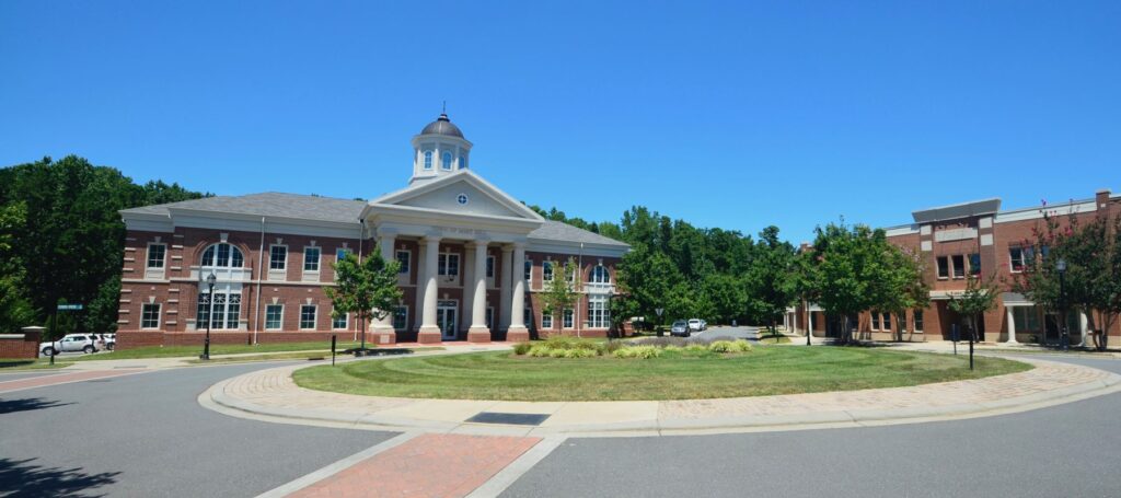
HOA Management in Mint Hill, NC
William Douglas is proud to offer HOA Management and Association Management services in Mint Hill, NC, a suburb southeast of Charlotte.
Mint Hill, North Carolina, or the Town of Mint Hill, is located in both Mecklenburg and Union counties, but predominantly Mecklenburg County. Mint Hill is a suburb of Charlotte and is considered a bedroom community of Charlotte. Downtown Charlotte is approximately 13 miles from Mint Hill. Clear Creek, the predecessor community name of Mint Hill, has the distinction of being the first community established within Mecklenburg County. The community of Clear Creek was established by Scots-Irish settlers around 1750.
The 1980 U.S. Census population calculation for Mint Hill was 7,915, and the estimated 2019 U.S. Census population was calculated at 27,617.
Mint Hill’s zip code is 28227.
The area codes for Mint Hill are 704 and 980.
Mint Hill has a total land area of 23.92 square miles per the 2010 U.S. Census.
The population per square mile per the 2010 U.S. Census was 949.8.
Coordinates are Latitude: 35°10′19.91″N, Longitude: 80°39′20.88″W per Google Earth.
Mint Hill is located within both Mecklenburg and Union counties. The origin of Mecklenburg County is traced back to 1762, when it was created from the western part of Anson County. Union County was created in 1842 from an eastern area of Mecklenburg County and the western section of Anson County.
After Mecklenburg County was reduced in size in 1842 to create Union County, the next U.S. Census for Mecklenburg County in 1850 determined the population to be 13,914. Mecklenburg County’s population was calculated at 919,628 when the 2010 U.S. Census was conducted. The estimated Mecklenburg County population for 2019 per the U.S. Census was 1,128,945.
The first U.S. Census for the newly created Union County was 1850, and the population was calculated to be 10,051. By the 2010 U.S. Census, Union County’s population was determined to be 201,292. The estimated Union County population for 2019 per the U.S. Census was determined to be 244,562.
A Brief Historical Overview of Mint Hill and the Surrounding Area
The Catawba River Basin has a long and rich history of Native Americans inhabiting the area. Mint Hill is considered to be in the “Lower Catawba” area of the basin. The lower Catawba basin’s main tributaries are Irwin Creek, McAlpine Creek, Six Mile Creek, Sugar Creek, Twelve Mile Creek, and Waxhaw Branch. The area around these many tributaries and the Catawba River itself was fertile for farming, fishing, and hunting. Artifacts have been discovered at Native American archaeological sites in the region, dating back as far as five thousand years.
The Catawba, Waxhaw, and Sugeree Indians were the first recorded inhabitants of the future Mecklenburg and Union counties within the Catawba River Basin. This early record of the Catawba Indians is derived from the writings of 16th-century European explorers. In 1540, Spanish explorer Hernando de Soto and his expedition members are considered the first Europeans to document the Catawba Indians. De Soto’s expedition is chronicled in the semi-anonymous writings of a supposedly Portuguese knight with the nom de guerre of a Gentleman of Elvas. In his work, he claimed to be a member of the expedition. His work was first published in 1557. Spanish King Charles I’s factor (accountant in present-day terms.), Luys Hernández de Biedma compiled a detailed report of the expedition that was presented to the Spanish King’s court in 1544. This original report survives in Spain’s national archives to this day. Gonzalo Fernández de Oviedo y Valdés in his penning of La historia general y natural de las Indias, employed de Soto’s personal secretary, Rodrigo Ranjel’s expedition journal as a source document. The expedition material sourced from Ranjel’s journal was first published in 1851. Ranjel’s journal, an original first-person account of the expedition, has been lost to time.

The Indians of the Catawba River Basin are next chronicled due to Spanish explorer Juan Pardo’s expedition of 1567. This expedition is chronicled in Vandera’s narratives of Pardo’s expedition. Vandera denotes the Catawba Indians as the Ysa Issa (Iswa).
German explorer John Lederer in his book The Discoveries of John Lederer, In three several Marches from Virginia, To the West of Carolina, And other parts of the Continent: Begun in March 1669 and ended in September 1670, records his encounter with the Indians of the Catawba River Basin. In this work, he refers to the Catawba people as the Ushery.
The area that would become Mint Hill was in the general vicinity of both the territories of the Catawba and the Waxhaw Indians. However, there is historical debate on whether the Waxhaw Indians were a distinctively separate tribe from the Catawba Indians or just a separate band. The historical debate revolves around the similarities in language and custom. One custom in particular that both practiced is the intentional deforming of their children’s heads. Infants were strapped to boards to flatten their foreheads. This custom resulted not only in permanently flatting the infant’s forehead but in setting the eyes unnaturally further apart.
If the Waxhaw Indians were a separate tribe from the Catawba Indians, they were considered extinct as an independent tribe after the early 1700s. Native American historian James Mooney noted in his work “The Aboriginal Population of America North of Mexico,” published by the Smithsonian Institute in 1928, stated that in the year 1600, the Waxhaw and Sugeree Indian’s population was 1,200. Likewise, Mooney observed in this work that the surviving members of these two tribes had integrated with other larger Native American tribes at some point but were no longer a distinct tribe.
The extinction of these tribes and the population decline of the Native American population as a whole was the result, to a large extent, of Intertribal conflicts and conflicts between colonists. However, the largest contributing factor to the Native American populations’ decline was smallpox. The introduction of European diseases that Native Americans had no natural built-up immunities to devastated their population. Smallpox, by far, was the deadliest. Smallpox is believed to have been first introduced in the early 1600s by European colonists. What is believed to be the first widespread smallpox epidemic that afflicted the Native American population happened in Plymouth, Massachusetts, in 1633.
In the 1700s, the Catawba Indians in what would become Mecklenburg and Union counties were devastated by smallpox epidemics. There were an estimated 25,000 Catawba Indians before European colonization of North Carolina and South Carolina began. The Catawba Indian population, by 1775, was estimated to be around 400; again, this plummeting population was primarily due to smallpox epidemics. The Catawba Indian population had only recovered to 2,600 by the 2010 U.S. Census.
As the Native American population declined in Mecklenburg and Union counties during the 1700s, European settlers arrived in greater numbers. These early settlers were German Palatines (commonly known as the Pennsylvania Dutch) and the Scot-Irish. In the 1740s, the Great Wagon Road from Philadelphia was the primary route these settlers used to reach Mecklenburg and Union counties. The left fork of this road that reached Augusta, Georgia, via Lancaster and Camden, South Carolina, was close to present-day Mint Hill. The new arrivals were primarily subsistence farmers, along with a small number of tradesmen. These tradesmen likely farmed to supplement their particular trade to survive.
The community of Clear Creek, the future Mint Hill, was established by Scots-Irish settlers around 1750. The early leaders of Clear Creek were influential within Mecklenburg County. Leading up to and during the American Revolutionary War, Mecklenburg County was a breeding ground of resistance in opposition to the British Crown. Clear Creek’s most prominent citizens, Captain Adam Alexander, John Foard, and John Query, were reportedly signatories of the Mecklenburg Declaration of Independence that was supposedly ratified on May 20, 1775.
Captain Adam Alexander (1728 – 1798) owned a large plantation in Clear Creek and was highly respected within Mecklenburg County. He served as the justice of the peace and county court magistrate. Most notably, he served as the commander of the Clear Creek Militia. Alexander had led his militiamen against Cherokee Indians during minor pre–American Revolution Indian uprisings. His Clear Creek Militia totaled 86 men on a roster dated June 7, 1766. In 1775 Alexander was promoted to a lieutenant colonel in the Mecklenburg County Regiment under Colonel Thomas Polk. He served as a lieutenant colonel in the 2nd Salisbury District Minutemen from 1775 to 1776. In 1776, Alexander was promoted to full colonel in command of the Mecklenburg County Regiment of Militia. It is believed that Alexander was in command of his regiment at the Battle of Moore’s Creek Bridge on February 27, 1776. While a relatively small engagement, the Battle of Moore’s Creek Bridge was important in that it was one of only two Patriot victories within the borders of North Carolina during the American Revolution. Alexander left active service in 1778.
John Foard (1727 – 1798) was a Scotsman who served as a judge for the Salisbury Court and had considerable land holdings around McAlpine Creek. Foard was known for his strong Presbyterian faith and being a member of the Rocky Springs Presbyterian Church. He served as a sergeant in the Clear Creek Militia.
John Query (1745 – 1827) was a Scotsman, and he had arrived in Clear Creek from Pennsylvania in around 1765. He was a constable, tax lister, and census taker. He was a member of the Rocky Springs Presbyterian Church. Query served as a corporal in the Clear Creek Militia.
In what would become known as the Battle of Charlotte, on September 26, 1780, around 160 Patriot militiamen from Mecklenburg County and surrounding areas skirmished with British soldiers at the Mecklenburg County Court House. At that time, the Mecklenburg County Court House was located at the center of town at what is now the intersection of Trade and Tryon streets.
The battle was actually a delaying or harassing action by the Patriot forces. Undeterred, the commanding general of the British forces in the south, Lord Charles Cornwallis, entered Charlotte to establish his headquarters. Cornwallis and his British force expended 16 unsuccessful days in Mecklenburg County, seeking to quell the rebellious patriots. Upon finally leaving Charlotte, Cornwallis purportedly was to have remarked: “Let’s get out of here; this place is a damned hornet’s nest.” Hence, the origin of the popular Mecklenburg County moniker, “The Hornet’s Nest.”
Prosperity continued in and around Clear Creek after the conclusion of the American Revolution in 1783. The first U.S. Census in 1790 of Mecklenburg County calculated the population at 11,395. As with much of the region, Clear Creek’s economy revolved around agriculture. Before the American Revolution, the majority of farms were small and at a subsistence production level. This subsistence existence continued, for the most part, after the American Revolution up until 1793.
The cotton gin was invented in 1793, and this invention had one major societal, economic benefit and one horrendous negative societal impact. The first societal, economic benefit being cotton cultivation moved many subsistence farmers to larger farms and the production of cash crops. Cash crops being crops produced for the market. The second horrendous negative societal impact being the expansion of the African slave trade and the resulting consequences of the slave trade. Cotton cultivation required a huge increase in the need for African slaves to work the cotton fields. In 1830, it was estimated that in North Carolina, cotton production came to 17,571 bales. Production nearly doubled to 34,617 bales by 1840. By 1850, North Carolina cotton production had doubled to 73,845 bales, and it came close to doubling again in 1860 with 145,514 bales produced.
Mint Hill was granted its first town charter at some point in the 1800s. It is not exactly known when. The first mention of Mint Hill is found in the newspaper archives.

“A new post office has been established in Mecklenburg County, called “Mint Hill.” J.S. Waters, P.M.” from The Charlotte Democrat, April 3, 1860
However, it is known when Mint Hill dropped its town charter and why. In 1910, the town charter was dropped so Mecklenburg County would build a road through Mint Hill. At that time, Mecklenburg County would not build roads through incorporated areas of the county.
On March 11, 1971, Mint Hill was chartered once again. This reincorporation was primarily due to the citizens of Mint Hill’s concerns about forced annexation from a surrounding municipality, primarily the force annexation by the City of Charlotte. There were also two contentious zoning issues with the Mecklenburg County Commission that played a role in the Mint Hill citizens supporting this reincorporation.
Mint Hill established a volunteer fire department in 1954. The first county library in Mint Hill was established in 1958.
Beginning around the middle of the 20th century, agriculture slowly began playing a smaller economic role for Mint Hill and the surrounding area. The urban sprawl of neighboring Charlotte and Mecklenburg County as a whole began to slowly change the economic drivers for Mint Hill and the area. Mint Hill started to become a bedroom community for Charlotte in the 1980s. The improved roads and overall thriving economic growth of Charlotte only increased this bedroom community status. The population of Mint Hill, as calculated by the 1980 U.S. Census, was 7,915. For 2019, the U.S. Census population estimate was 27,722. In the last thirty years, the population boom is due to residential development geared towards commuters for Charlotte businesses.
Newspaper Items from the past:
From an article in The Charlotte Observer, March 5, 1897: “The people of Clear Creek are very much stirred up over a petition which is being circulated there, by certain parties, asking that the incorporations of Clear Creek and Arlington churches be restricted by one and two miles – two miles for Arlington Church and one mile for Clear Creek. It’s alleged that the parties wish to sell whiskey in the restricted limits. The people of Clear Creek are opposed to it. They say, and wisely, that the sale of whiskey should be restricted to the towns, where police protection can be had.”
From an article in the Mecklenburg Times, October 4, 1894: “Pat Mungo of Clear Creek township, was in the city Saturday. He reports that all is quiet in gold mining operations, crops are good and politics warm.”
From The Charlotte Observer, March 22, 1876: “Ordered by the Board that the order made on the 6,h inst. For holding an election in Clear Creek on the Prohibitory Liquor Law, be rescinded. Ordered by the Board that an election (70 persons petitioning) be held in Clear Creek Township on the 1st Monday in May next, for the electors of said township to vote whether or not spirits may be sold in said township.”
Need Association Management?
Contact Us
How to Start
The Process of Working With Us


REQUEST A PROPOSAL
Request a proposal online or call us directly.


WE WILL REVIEW YOUR CASE
Our team of highly trained professionals will review your case.


RECEIVE A CUSTOM TAILORED PLAN
We will create a customized management plan for your community.


SEAMLESS TRANSITION
We will implement a seamless management transition and integrate our tech.


SIT BACK & RELAX
Enjoy better, affordable and a more reliable, hassle-free management system.
OUR REVIEWS
What Our Clients Say

We never lived in an area where they had HOA’s or property management companies before, so this is all new to us. Our experience with William Douglas PMC is kind of limited, but in recent months we have dealt with it more because our subdivision is being turned over to what will be our HOA very soon. I’ve had questions and each time I’ve contacted WDPMC I have received a timely response.

As Treasurer of our HOA, it’s a pleasure to work with William Douglas Property Management. They make our life so much easier!

This company has helped save our neighborhood.