
HOA Management in Moncks
Corner, sc
Moncks Corner, South Carolina, is a town in Berkeley County. Moncks Corner is also the county seat for Berkeley County. As of 2020, Moncks Corner was the fourth-fastest-growing town in South Carolina and within the fastest growing county within the state. The proximately to Charleston and the industries located in the immediate area have spurred this rapid growth. As of 2020, the median home value in Charleston was $336,539, and in Moncks Corner, it was $233,002. Moncks Corner is situated only minutes from the tourist locations and beaches in and around the Charleston area.
Moncks Corner is conveniently located between the Boeing assembly plant in North Charleston. This Boeing manufacturing, assembly, and delivery site is the largest employer in the area and one of the largest employers in the state. Volvo has its American car manufacturing facility in Ridgeville. Volvo is also one of the largest employers in the region. Berkeley County is considered one of South Carolina’s main industrial hubs.
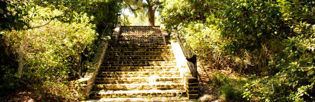
Sites to see in Moncks Corner: Biggin Church Ruins, Cooper River Historic District, Cypress Gardens, Francis Marion National Park, Lake Moultrie, Lewisfield Plantation, Mepkin Abbey, Mulberry Plantation, Santee Canal, and Strawberry Chapel and Childsbury Town Site.
Moncks Corner at one time was spelled with an apostrophe “s,” such as Monck’s Corner. The apostrophe began to be omitted sometime around 1898.
Berkeley County was first established in 1682. The county was named for Lord John Berkeley and Sir John Berkeley, and they were two of the Lord’s Proprietors. In 1769, Berkeley County became part of the Charleston District. In 1882, it was divided into the separate Berkeley County once again.
Moncks Corner’s population, as of the 2010 U.S. Census, was 7,885. The U.S. Census Bureau estimated population as of 2019 was 11,986.
The total area of Moncks Corner is 7.29 square miles per the 2010 U.S. Census.
Coordinates – Latitude: 33°11′45.61″N, Longitude: 80°00′47.29″ W per Google Earth.
Moncks Corner is approximately 15 miles from neighboring Goose Creek. The Charleston Battery (Historic part of Charleston) is approximately 35 from Moncks Corner. Moncks Corner is approximately 17 miles from Summerville and 25 miles from North Charleston.
Per Google Earth, elevation above sea level: 61 feet.
The Zip codes for Moncks Corner are 29430 and 29461.
Telephone area codes for Moncks Corner are 843 and 854.
Moncks Corner is located in the Coastal Plain Region of South Carolina. This region of South Carolina is commonly referred to as the “Low Country.”
Moncks Corner is located within the Charleston-North Charleston Metropolitan Statistical Area (MSA). Three counties compose the Charleston-North Charleston MSA: Berkeley, Charleston, and Dorchester. Per the 2020 U.S. Census, the population of the Charleston-North Charleston MSA increased to 799,636 from the 2010 U.S. Census, which calculated a population of 664,607. As measured by population, the Charleston-North Charleston MSA is the 74th largest in the United States. This is a rise from 75th place in the 2010 U.S. Census. In the state, the Charleston-North Charleston MSA is 3rd in size. The Greenville Metropolitan Statistical Area is the largest in the state, 60th in size nationally. The Columbia, SC Metropolitan Statistical Area is second largest in South Carolina and 72nd in the United States.
Moncks Corner – A brief historical overview
The town’s name originates from Thomas Monck (circa 1685 – 1747). Monck purchased 1,000 acres in St. John’s Berkeley Parish on August 22, 1735, from James Le Bas. He constructed a plantation that he named Mitton. On a part of his plantation, there was a fork where the Charleston Road branched off with the Congaree Road. This fork is where the first Moncks Corner settlement was located.

A number of trails and roads were reached by this fork in the road at what developed into Moncks Corner. Over time, a little center of commerce developed. From Samuel DuBose’s “Reminiscences of St. Stephen’s Parish, Craven County,” prior to the American Revolution, “Moncks Corner was a place of some commercial importance.” The fork in the road was host to three or four well-maintained taverns and five or six fine established stores. Some of these stores were reportedly branches of larger stores located in Charleston. The first store at Moncks Corner, around 1739, may or may not have been owned by Thomas Monck; the records are not clear. It is known that this first store was operated by a Swiss immigrant named Simeon Theus. Thomas Monck was a merchant with operations in Charles Town, and this could have possibly been a branch of his store there. Simeon Theus was a captain in the First Regiment of the South Carolina Militia during the American Revolution.
Because of its convenient location, Moncks Corner became a hub of commerce for the surrounding area population and travelers. Santee planters and farmers would take their crops to Moncks Corner to sell and buy supplies. Travelers would break their journey by stopping in or staying in one of the taverns. Some of the early merchants at Monck Corner were Neufville and Anderson around 1756, Thomas White around 1759, Dawson and Dudley around 1763, Dawson and Walter around 1772, Thomas Giles and Company around 1776, and John Giles and Company around 1777.
Thomas Monck died in 1747, and his second wife, Mary Monck, continued her dead husband’s business interests until 1752, when she sold the plantation to William Keith. Monck’s daughter Joanna Broughton Monck married John Dawson in 1760, and they operated a general store and trading post at the fork in the road around 1763. Probably South Carolina’s first stagecoach route in 1766 was Charles Town and Moncks Corner, twice a week.
The European settlers were attracted to the Moncks Corner area because of the rich soil and abundance of water. Cultivating rice was one of the area’s main crops. Settlers to the Charles Town (Charleston) area between 1670 and 1690s were primarily English, Barbadians of English origin or descent, and African slaves. In the 1690s into the 1700s, Reformed Swiss, German Lutherans, and French Huguenots began arriving.
The Lord’s Proprietors of Carolina administered the Carolina colony beginning in 1663. Thus, the colony was not a Royal Colony while under the Lord’s Proprietors of Carolina. While King Charles II retained sovereignty over the Carolina colony, the Lords Proprietors had broad authority to govern and promote immigration to the colony.
The Lords Proprietors recruited settlers with independent, self-reliant traits, such as the English Barbadians and the Reform Protestants. It was assumed these traits would make successful settlers to the colony. However, these settlers were perhaps too independent and self-reliant because a number of them caused a great deal of consternation with the Lord’s Proprietors and their colonial administrators. Some of the Moncks Corner area population, and especially some in the neighboring Goose Creek area, were some of the most ardent opponents of their rule.
During the Yamasee War, a pivotal battle occurred south of present-day Moncks Corner on June 13, 1715. While the battle is known as the Battle of Goose Creek, it took place north of Goose Creek between Moncks Corner in the Strawberry community. From Moncks Corner, south on U.S. Highway 52, turn left onto Cypress Gardens Road, travel a little over a mile, and turn right onto Old Fort Road/Old U.S. Hwy 52. Travel a little over a mile, Avanti Lane, and a historical marker will be on the left with a small parking area.
This location is identified as St. James, Goose Creek Chapel of Ease Historical Site, which marks the site of the Battle of Goose Creek. This battle was pivotal in that the population in the Charles Town area was most likely not substantial enough to survive the Indian raid if it had not been stopped at this battle. This battle spared the surviving Goose Creek population and, conceivably, the entire South Carolina colony from obliteration.

The site of the future St. James, Goose Creek Chapel of Ease, in 1715 was just a campsite, “The Camp,” on the Congaree Road, also known called the Cherokee Path that led into the untamed and underexplored backcountry. The site was known as a good place to rest, leaving Charles Town or to rest when exiting the backcountry.
The local trade in the area included the illegal trade of Native American slaves, sold by other Native Americans for exporting through Charles Town harbor. The Native American slave trade was one of the causes of the Yemassee War in 1715. When Indians raids became a threat to the sparsely populated areas around Charles Town, many of the settlers fled to Charles Town. However, many of the locals refused to leave. One of these that was refusing to leave being militia Colonel George Chicken. Chicken and a contingent of 120 men consisted of militiamen, white and black settlers, and Etiwan Indians.
Chicken and his men fortified The Camp with makeshift ramparts. A large Indian raiding party attacked The Camp and was driven off towards the Wassamassaw swamp. Chicken executed a devastating ambush two days later at Wassamassaw, thus preventing the Indians’ advance on Charles Town. Chicken, who owned the land where The Camp was located, donated it for the construction of a chapel of ease for the St. James Goose Creek Parish.
Much of this colonialist animosity derived from the Lord’s Proprietors retraining certain business enterprises. One of these being the enslaving of Native Americans, which the Lords Proprietors had made illegal. In addition, the failure of the Lords Proprietors to quell Indian hostilities eroded any remaining colonist’s support for the Lords Proprietors. In December of 1719, the colonist petitioned King George I to assume unequivocal control of the colony. Asking King George I to turn the Carolina colony into a Royal Colony and end the Lord’s Proprietors’ governance. King George II negotiated an end to the Lord’s Proprietors’ rule that led to the transfer of the Carolina colony in 1729 to England.
This transfer from Lord’s Proprietors’ authority to a Royal Colony only seemed to slightly subdue the political discourse in the South Carolina colony. The concerns that caused animosity with the colonists towards the Lord’s Proprietors, taxation, and lack of political representation, were still points of contention after the transition to a Royal Colony. These problematic issues festered for the next forty-seven years, not only in the South Carolina colony but all thirteen original colonies, cumulating with the American Revolutionary War (1775 – 1783).
Charleston and the outlying areas were hotbeds of resistance to the Royal Crown during the American Revolution (1765 – 1783). Revolutionary War militia Generals Francis Marion and William Moultrie were from the Moncks Corner area. The Battle of Monck’s Corner was fought on April 14, 1780, between mainly British Loyalist soldiers, numbering around 1,400, and Patriot militia, numbering around 500. This battle was important because Charleston was being besieged by British General Sir Henry Clinton, and it was along the Charleston Road and the Congaree Road. A very important logistical crossroads for the Continental Army.
Lieutenant Colonel James Webster was in overall command of the British force. In command of the Loyalist British Legion at the Battle of Monck’s Corner was the infamous Lieutenant Colonel Banastre Tarleton. The British Legion was a colonial regiment comprised of British Loyalist American infantry and dragoons (cavalry). The British Legion was also known as Tarleton’s Raiders, the Green Devils, the Green Horse, and the Green Dragoons. Tarleton and his men would later become known for their brutality towards surrendering Continental soldiers at the Battle of Waxhaws on May 29, 1780. Reportedly, to a limited degree, Tarleton’s men showed brutality to surrendering militia soldiers at this battle.
British forces at the battle also included Loyalists from the 33rd Foot (infantry) and 64th Foot. In addition, Major Patrick Ferguson led the American Volunteers, which was comprised of British Loyalists. Ferguson was a Scottish officer in the British Army who, to great effect, recruited Loyalists to fight against the Patriots. Considered to be one of the most effective British officers, he was later killed at the Battle of Kings Mountain on October 7, 1780.
The British force attacked the Patriot forces in Moncks Corner in the early morning hours of April 14, 1780. Taking the Patriot force by surprise, the British attack began at 3:00 AM, and it soon turned into a rout. In John Buchanan’s The Road to Guildford Courthouse, published in 1997, Banastre Tarleton is quoted as, “The Americans were completely surprised, General Huger, Colonels Washington, and Jamieson, with many officers and men, fled on foot to the swamps..” The Battle of Monck’s Corner eliminated one of Continental General Benjamin Lincoln’s forces’ supply routes to the besieged Charleston. The battle also had the effect of eliminating one of the escape routes of the Continental Army besieged in Charleston.
After the American Revolution, there were additions and improvements to the transportation infrastructure in rural South Carolina. The South Carolina State Road between Charleston and Columbia that was completed after the American Revolution and other new roads diverted travelers from Moncks Corner. The Santee Canal, completed in 1800, was twenty-two miles in length and connected the Santee River to the Cooper River. The waters of Lake Moultrie covered the majority of the original canal in the 1940s. A remaining portion of the canal still exists just east of Moncks Corner. The Old Santee Canal Park is located at the southernmost point of the original canal at the headwaters of the Copper River.
The new roads and the canal diverted travelers from Moncks Corner’s general stores and taverns. When the Santee Canal was completed in 1800, this spelled the beginning of the end of Moncks Corner as a trading post. As the utilization of the canal increased, commerce in Moncks Corner decreased, as did the population. The Moncks Corner settlement almost disappeared during the next five decades. This all changed with the arrival of the Northeastern Railroad in 1856.
The Northeastern Railroad was chartered by the South Carolina Legislature and formed in 1851. The City of Charleston and Charleston banks were the primary investors of the railroad. The rail line was complete and was operational by 1857 from Charleston to Florence, South Carolina, totaling 102 miles. Fortunately for Moncks Corner, population density did not factor into the railroads’ track laying decisions because to reach Florence, the rail line’s route had to be laid through rural and sporadically populated areas.
The railroad brought about a great many changes to Moncks Corner. The most drastic being moving what remained of the original settlement to the rail line. A granite marker can be found at the original settlement site located in the 400 block of North Highway 52, Moncks Corner (33° 12.187′ N, 79° 59.335′ W). Present-day Moncks Corner town limits encompass the old settlement area and Thomas Monck’s original Mitton Plantation.
The move of just over a mile southwest of the original settlement to the rail line and train depot began around 1856. The new center of Moncks Corner became the Northeastern Railroad depot. The original train depot is still in existence at the corner of Behrman Street and East Main Street. The train depot has been restored and is available to the town and non-town residents to rent out for special events.
Moncks Corner received its town charter on December 26, 1885, and was incorporated on December 15, 1909. When Mount Pleasant became part of Charleston County again, the county seat for Berkeley County was moved to Moncks Corner in 1897. The first school opened in 1913, and the first bank, the Farmers’ and Merchants’ Bank, in 1918. This was followed two years later with the People’s Bank in 1920. In 1945, South Carolina Public Service Authority, also known as Santee-Cooper, moved its headquarters to Moncks Corner. Santee-Cooper was formed during President Roosevelt’s New Deal to provide electricity and water to South Carolina residents. Close by Lake Moultrie, and Lake Marion were both created by Santee-Cooper. Santee-Cooper resulted in a great deal of population growth in the town and surrounding area.
Need Association Management?
Contact Us
How to Start
The Process of Working With Us


REQUEST A PROPOSAL
Request a proposal online or call us directly.


WE WILL REVIEW YOUR CASE
Our team of highly trained professionals will review your case.


RECEIVE A CUSTOM TAILORED PLAN
We will create a customized management plan for your community.


SEAMLESS TRANSITION
We will implement a seamless management transition and integrate our tech.


SIT BACK & RELAX
Enjoy better, affordable and a more reliable, hassle-free management system.
OUR REVIEWS
What Our Clients Say

We never lived in an area where they had HOA’s or property management companies before, so this is all new to us. Our experience with William Douglas PMC is kind of limited, but in recent months we have dealt with it more because our subdivision is being turned over to what will be our HOA very soon. I’ve had questions and each time I’ve contacted WDPMC I have received a timely response.

As Treasurer of our HOA, it’s a pleasure to work with William Douglas Property Management. They make our life so much easier!

This company has helped save our neighborhood.