
HOA Management in Mount Holly,
NC
Mount Holly or Mt. Holly, North Carolina, is a city located in eastern Gaston County. Of the fourteen municipalities within Gaston County, Mount Holly is the second largest behind the county seat of Gastonia. Mount Holly was incorporated as a city on March 11, 1879. Mount Holly has evolved from originally being a rural farming community in the mid-1700s to one of the largest textile-producing areas of the region beginning in the mid-1800s. Since the decline of textile manufacturing, beginning in the 1970s, Mount Holly has evolved once again into a bedroom community for Charlotte and its vibrant and ever-growing economy.
The Town of Mills River, N.C.
Gaston County was formed from the southern part of Lincoln County in 1846. Gaston County was named for William J. Gaston (1778 – 1844), a North Carolina Supreme Court member and a United States Congressman. The 1850 U.S. Census for the newly formed Gaston County was 8,073. The population of Gaston County per the 2020 U.S. Census was 227,943. Per the 2010 U.S. Census Bureau, Gaston County is 356.03 square miles, with a population per square mile of 578.8.
Gaston County is located in the Piedmont region of North Carolina. The majority of Gaston County is considered to be in the Catawba River Basin. The very western edge of Gaston County is considered to be within the Broad River Basin. Both the Catawba and Broad river basins are part of the Santee River Watershed. The Catawba River comprises the eastern county line or border of Gaston County with Mecklenburg County. Lincoln County borders Gaston County on the north, Cleveland County borders on the west, and South Carolina’s York County borders on the south.
A brief overview of the Mount Holly Area
Discoveries at Native American archaeological sites around the region have found evidence of inhabitants dating back at least 5,000 years. With its fertile land and abundant wildlife, the Catawba River Basin appears to have been home to many thousands of Native Americans. Documentation of these inhabitants is limited to the last five hundred years or so when European explorers arrived. The first documented inhabitants of the future Mount Holly area were the Cherokee Indians. The Catawba River served as the territorial boundaries with their traditional enemies, the Catawba Indians, before the time of European colonization.
The early documentation of both the Cherokee and Catawba people comes from the chroniclers of the 1540 expedition of Spanish explorer Hernando de Soto. The exact route of de Soto’s expedition is unknown. It is thought that the expedition crossed present-day North Carolina into present-day Mecklenburg or present-day Gaston counties. From there, the expedition traveled north to the Native American village of Guaquili, which was believed to be near the present-day City of Hickory, North Carolina. It can be speculated that de Soto’s expedition traveled through future Gaston and Lincoln counties to reach Hickory which is in Catawba County
The next European explorer to document the region and their encounters with Native Americans was the Spanish explorer Juan Pardo in 1567. The Pardo expedition’s precise route is not conclusive, and it is more definable than de Soto’s expedition route. Pardo’s encounters with Native Americans were chronicled in Vandera’s narratives of Pardo’s expedition. Vandera describes in his narratives of being in present-day Gaston County, a league downriver from Ysa, on the “other side of the river” where gems could be found. This location is speculated to be Beaverdam Creek near the present-day community of High Shoals.
The Carolina Native American Census of 1715 showed the Catawba Indian population was around 1,800, and their territory had expanded into present-day Gaston and Cleveland counties. In this census, the Cherokee people had an estimated population of 11,200, and their territory had been consolidated in the far western part of present-day North Carolina and over into present-day Tennessee. There is not much documental evidence of the Native American inhabitants of the present-day Mount Holly area; however, what can be assumed is that the Catawba River area where Mount Holly is now located was fertile land and certainly had an abundance of wildlife. The area would have been suitable and abundant to support a large number of Native American inhabitants.
Immigration to the future Gaston County and Mount Holly areas began en masse in the mid-1700s. These early immigrants were predominantly Scots, Irish, Pennsylvania Dutch (immigrants of German extraction), and English. For the most part, these settlers arrived via the “Great Wagon Road” that originated in Philadelphia with a route through Maryland, Virginia, North Carolina, South Carolina, and ending in Augusta, Georgia.
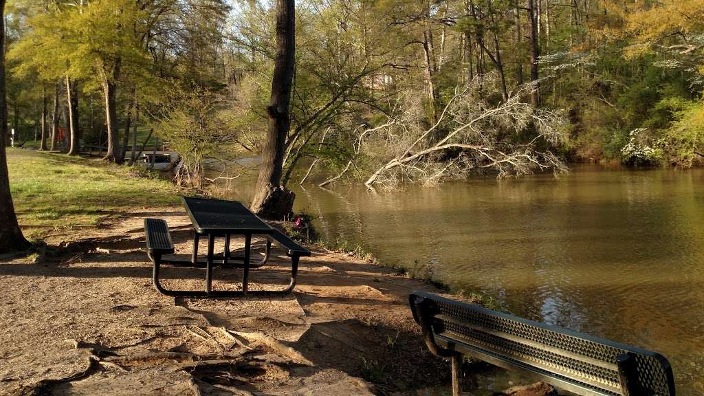
The Tuckaseege Ford on the Catawba River abutted what would become Mount Holly. The Tuckaseege Ford was a major east-west crossing point of the Catawba River going to and from Charlotte. The Tuckaseege Ford was located in the proximity of the present-day River Front Homeowners Association (HOA) residential development. Present-day Mount Holly is situated on land that English King George II granted to George Rutledge in 1754. The land grant is described as a parcel of land ”on the so. side of the Catawba River on Kuykendall, the Dutchman’s Creek.”
Created with being the first European settler to present-day Mount Holly was Captain Robert Alexander (1743 – 1813). Captain Alexander emigrated from Pennsylvania to Lincoln County around 1760. He farmed the land where Mount Holly is today. He resided in a Woodlawn House, which devised the first name of what would become Mount Holly, “Woodlawn.” Alexander’s Woodlawn House was located off Tuckaseege Road, one mile northwest of Tuckaseege Ford, on the Catawba River. Woodlawn House once stood at the corner of present-day Hawthorne Street and W. Central Avenue, adjacent to the Mount Holly Middle School. Woodlawn House was painted red, and travelers along Tuckaseege Road gave Woodlawn House the moniker the “Red House Place.”
Alexander was a Patriot delegate at Newborn on August 25, 1774, and he attended the Hillsborough Convention in August 1774 and August 1775. During the American Revolution and the Cherokee War of 1776, he commanded a militia company under General Griffith Rutherford. After the American Revolution, Alexander returned to his farm off Tuckaseege Road. Alexander served in the North Carolina State Legislature from 1781 to 1787.
Another early settler in the area was Miles Abernathy(1750 – 1812). Miles Abernathy was known for building a flat bottom boat every year and loading it with barrel staves (narrow strips of wood used for the sides of barrels). He would then float the boat down the Catawba River to Charleston and sell it all. Mr. Abernathy would take his proceeds and walk back to present-day Mount Holly. Miles Abernathy and his wife Ursula had nine children, and many of these children had large families promulgating the Abernathy name through the region through today.
Around 1830, Frederick Hoffman and Moses Rhyne opened a general store near the Tuckaseege Ford. The Hoffman-Rhyne general store became the commerce and communication hub of the area. A Woodlawn post office was established around 1838. In 1842, a community meeting was held to discuss creating a Gaston County.
In 1848, John L. Tate from Greensboro purchased the land around the falls on the Catawba River. He reportedly moved his cotton mill by wagon to then Woodlawn. He assembled a three-story high brick cotton mill, which became the first river-powered mill in Woodlawn. Tate named his mill the Mountain Island Mill. The employee housing, or mill houses, were single-family dwellings of brick as well.
The Carolina Central Railway arrived in Woodlawn in 1860. The trains arrived announced the beginning of the industrial age to the area. The American Civil War and the following Reconstruction resulted in an economic downturn for the area and the entire south. The economic downturn only began to recover in the late 1880s. Textiles led to the economic recovery for the majority of the south.
The railroad was the first west of the Charlotte and the Catawba River in North Carolina. The Carolina Central Railway named their depot Tuckaseege Station. The name Tuckaseege Station is what some began calling the area thereafter, while others continued to call the area Woodlawn. Sometime before 1888, the name Woodlawn Station replaced Tuckaseege Station. The arrival of the railroad led to more production from current cotton mills and incentivized the construction of additional mills. In 1888, the railroad officially changed the name of the train stop from Woodlawn to Mount Holly.
Due to population and economic growth, there was demand from the residents to incorporate a city. The North Carolina General Assembly incorporated the City of Mount Holly on March 11, 1879. The Mount Holly name has two possible origins. The first being the Mount Holly Cotton Mills, built in 1874 by A.P. Rhyne and D.E. Rhyne, on Dutchman’s Creek. The actual mill name supposedly derives from Mount Holly, New Jersey, where at the time, the best yarn was produced. The second possible origin was a stand of holly trees on the banks of Dutchman’s Creek that flows through the city.
-From The Daily Review, September 5, 1879, edition: “Postmaster D E Rhyne addresses us a note stating that the name of the post office lately known as Woodlawn, Gaston County, has been changed to Mount Holly, to conform to the name of the village and that the change takes effect immediately.”
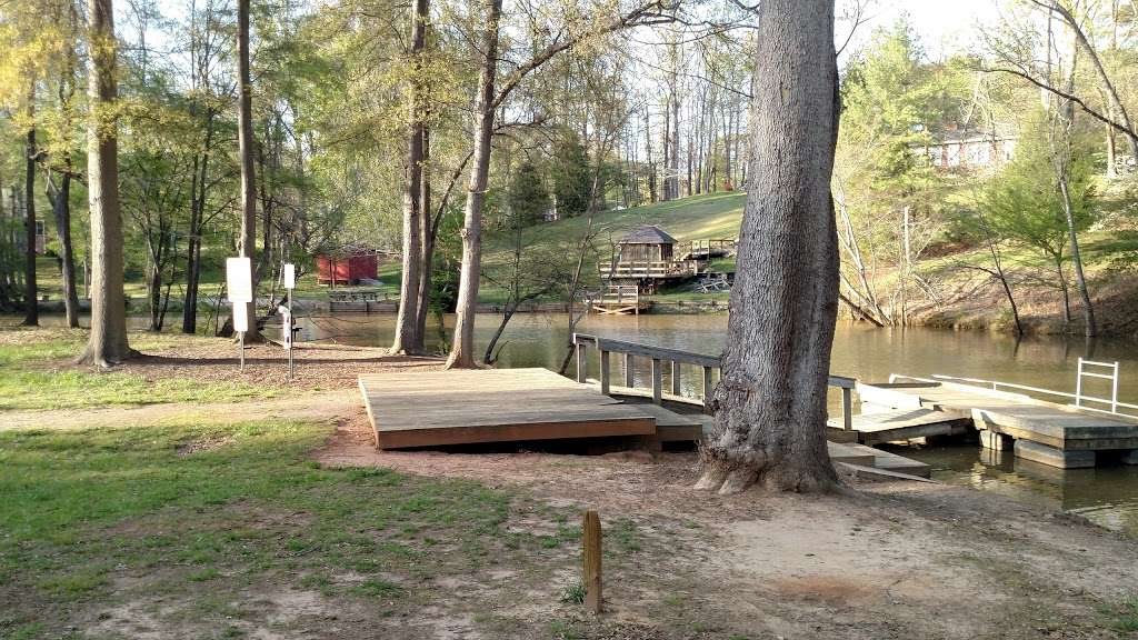
Mount Holly was a tourist destination even before the U.S. National Whitewater Center opened. There are numerous accounts of travelers from Charlotte and other surrounding towns coming to Mount Holly for day excursions and picnics. The Catawba River area is still a scenic destination.
-From The Lenoir Topic, June 3, 1885, edition: “On the Catawba river[sic] at Mount Holly a steam launch, or lighter, brought from Wilmington, has been put down and will be used mostly by picnic parties.”
-From The Charlotte Observer, June 7, 1885, edition: “St. Pete’s S.S. Excursion Pic-Nic. The board of managers of the picnic to be held at Mount Holly on next Tuesday, will provide that no objectionable parties be admitted on the train or picnic grounds, that no liquor will be sold, and that the utmost decorum will prevail…The music, steamboat, and picnic grounds will be under the strict control of gentlemanly managers.”
By the earlier 1900s, there were four mills within Mount Holly. Textile production became Mount Holly’s largest industry by far. The Catawba Power Company, in 1913, constructed Gaston County’s first steam electric power plant at Mount Holly on the Catawba River. Duke Power Company eventually purchased the Catawba Power Company and the steam electric power plant.
The Piedmont & Northern Railway Company was an electric street railway company that ran from Charlotte to Mount Holly. The Charlotte to Mount Holly passenger line began operation on April 3, 1912. The Piedmont and Northern Railway was the idea of William States Lee in 1909. Lee was vice-president of Southern Power & Utilities Company, which later became Duke Power Company. Lee envisioned an “electrically powered inter-urban railway system linking the major cities of the Piedmont Carolinas.”
As did the agriculture economy of the Mount Holly area wane the late 1800s, so did the textile economy in the late 1900s. At the beginning of the 1900s, textile production was the leading economic driver in Mount Holly and the surrounding areas. This began to change in the 1970s and 1980s when imported textile production began to dominate the market. The North American Free Trade Agreement (NAFTA), the trade agreement between the United States, Mexico, and Canada that was ratified in 1993, was one factor that exacerbated the decline of domestic textile production. Decreasing employment trends in textile manufacturing had already been occurring; however, NAFTA accelerated this trend.
Construction on Interstate 85 is completed in the early 1960s. Downtown Mount Holley is approximately three miles from the new interstate. In the early 1980s, North Carolina Highway 273 bypass is completed. Both roads position Mount Holly unknowingly into becoming a bedroom community for Charlotte as Mount Holly’s economy moves away from textile production.
In the 2000s, Interstate 485 opened with an onramp around three miles from downtown Mount Holly. Around this same time, the U.S. National Whitewater Center opened on the east side of the Catawba River across from Mount Holly. This development has been a boom to businesses that cater to tourists.
Textile manufacturer American & Efird Inc. has played a huge role in the economy of Mount Holly for over 70 years and still does today. The Freightliner Truck manufacturing facility was annexed into the city limits of Mount Holly in 1990. National Gypsum has been manufacturing wallboard in Mount Holly since 2007.
The close proximity to Charlotte has driven economic development in Mount Holly and Gaston County. Charlotte’s economic boom has spread to the other surrounding counties and municipalities. Being a relatively short distance to Charlotte, with an easy daily commute, Mount Holly has become an option for people looking for a less hectic lifestyle or lower property taxes.
Mount Holly Quick Facts
Elevation of Mount Holly above sea level per Google Earth: 634 feet
Zipcodes for Mount Holly are 28120 and 28012
Mount Holly telephone area codes are 704 and 980
Coordinates of Mount Holly per Google Earth – Latitude: 35°17′53.57″N, Longitude: 81°00′57.27″ W
Mount Holly is around 16 miles from downtown Charlotte. Raleigh is approximately 178 miles from Mount Holly. Asheville, NC, is approximately 115 miles from Mount Holly. Greensboro is approximately 103 miles from Mount Holly. Columbia, SC, is approximately 99 miles from Mount Holly. Atlanta is approximately 236 miles from Mount Holly. Richmond is approximately 302 miles from Mount Holly.
– Per the 2020 U.S. Census, the population was 17,703.
– Per the 2010 U.S. Census, the population was 13,656.
– Per the U.S. Census Bureau 2015-2019, there were 6,134 households within Mount Holly.
– Per the U.S. Census Bureau 2015-2019 persons per household: 2.54.
– Per the U.S. Census Bureau 2015-2019:
High school graduate/higher of those over 25 years of age: 90.6%.
– Per the U.S. Census Bureau 2012. There are 893 businesses with Mount Holly
– Per the 2010 U.S. Census, the land area of Mount Holly: 9.79 square miles.
– Per the 2010 U.S. Census, population per square mile: 1,395.2.
– Per the U.S. Census Bureau 2015-2019:
Need Association Management?
Contact Us
How to Start
The Process of Working With Us


REQUEST A PROPOSAL
Request a proposal online or call us directly.


WE WILL REVIEW YOUR CASE
Our team of highly trained professionals will review your case.


RECEIVE A CUSTOM TAILORED PLAN
We will create a customized management plan for your community.


SEAMLESS TRANSITION
We will implement a seamless management transition and integrate our tech.


SIT BACK & RELAX
Enjoy better, affordable and a more reliable, hassle-free management system.
OUR REVIEWS
What Our Clients Say

We never lived in an area where they had HOA’s or property management companies before, so this is all new to us. Our experience with William Douglas PMC is kind of limited, but in recent months we have dealt with it more because our subdivision is being turned over to what will be our HOA very soon. I’ve had questions and each time I’ve contacted WDPMC I have received a timely response.

As Treasurer of our HOA, it’s a pleasure to work with William Douglas Property Management. They make our life so much easier!

This company has helped save our neighborhood.