
HOA Management in Mount Pleasant, SC
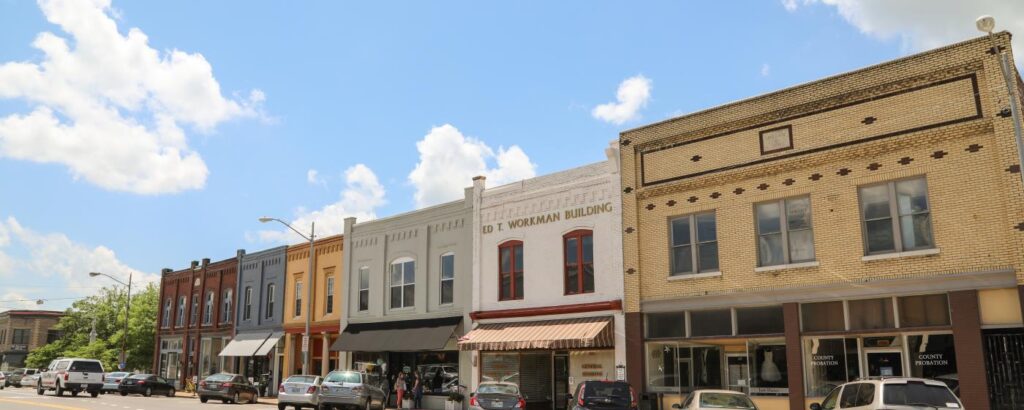
In recent years, the city of Mount Pleasant has received many “best of” accolades and, as an All-America City, it certainly lives up to its namesake.
Mount Pleasant, South Carolina, is a town in Charleston County. Mount Pleasant is the fourth-largest municipality in South Carolina, and its population per the 2010 U.S. Census was 67,843. The U.S. Census reported the estimated population in 2019 to be 91,684. Per the U.S. Census, the town has a total area of 45.08 square miles. Latitude: 32°47′13″N, Longitude: 79°52′35″W. The zip codes for Mount Pleasant are 29464, 29465, 29466, and 29429. The area codes for Mount Pleasant are 843 and 854.
Mount Pleasant is located in the Outer Coastal Plain Region of South Carolina at an elevation of 16’ above sea level. Mount Pleasant is the first town after leaving Charleston crossing the Arthur Ravenel Bridge. It is approximately 5 miles from Meeting Street in Charleston.
A brief historical overview of Mount Pleasant / Part One – Pre-Revolution Era
Archaeological discoveries indicate Native American settlements in the area of Mount Pleasant and Cooper River basin dating back 3,000 to 4,000 years. The discoveries in this time range center around remnants or “trash” left by the inhabitants, such as animal bones, shells, and pottery. Distinctions between Native American tribes in the area is not attained until around 1,200 years ago. These Native Americans became known as the Wando Indians because they inhabited the area around the Wando River. The Wando Indians crafted distinctive pottery utilizing clay and limestone from the Wando River banks. The limestone was utilized to temper the clay, and its use was distinctive to these people. Tempering is basically the material that is mixed with the clay to keep the finished vessel from cracking when it dries. Their pottery many times had designs that were distinctive to their people.
In geographer Philip Lea’s “A New Map of Carolina” circa 1690 indicates a “Seewe (Seewee) Settlement” at the headwaters or origin of the Wando River. In geographer Herman Moll’s “Map of the Province of Carolina” circa 1715 indicates “Samp (Sampa) Indians” north of the Wando headwaters and the Wando Indians south of the Wando headwaters. This map also denotes a “Sewe (Seewee) Indian Fort” a short distance southeast of the Wando Indians.
European settlers arrived at the area that would eventually become Mount Pleasant on July 6, 1680. These arrivals were led by Captain Florentia O’Sullivan, who had received a land grant of 2,340 acres. This grant included the island, which became known as Sullivan’s Island, and the area that became known as Mount Peasant.
Fifty-one Congregationalists settlers arrived in Mount Pleasant in 1696. These Congregationalists were Puritan Protestants seeking religious freedom as provided for in the Lords Proprietors’ “Grand Model” or “Grand Modell.” Puritans were Calvinists who sought reform that abolished all lingering Catholic rituals, such as kneeling at Holy Communion, using the term priest, making the sign of the cross.
The Lord’s Proprietors of the Carolina resulted from King Charles II being restored to the English throne in 1660. The Lord’s Proprietors of the Carolina, as they became known, were eight loyal followers who Charles II rewarded with a land grant encompassing the entire “Carolina” territory. This land grant by Charles II was established by the Carolina land charters of 1663 and 1665.

Charles II retained sovereignty over the Carolina territory. However, the Lord’s Proprietors had broad authority to govern and promote colonization of the territory. To induce colonization, the Lord’s Proprietors were offering land grants and other incentives. They established a civil authority to maintain the functions of government, along with a judiciary to maintain law and order.
Probably one of the most significant developments of the Lords Proprietors was the “Grand Model” or “Grand Modell” as the basis for the Carolina territory’s development. The Grand Model consisted of a constitution along with a settlement and development plan for the colony. The Grand Model’s constitution was comprised of 120 articles or sections. These articles addressed many topics, but most notably religious freedom. While the constitution was never ratified, many of the principles or considerations were adopted for the Carolina colony, religious freedoms being one of them.
Each Congregationalist family was granted several hundred acres. These grants were situated between the Wando River and the Atlantic Ocean. This area is what eventually became Christ Church Parish (County). After the turn of the 19th century, the South Carolina Commons House of Assembly passed the Act of 1704 and the Church Act of 1706. These acts established ten parishes (counties) in the colony. Christ Church Parish was one of these ten parishes.
The first, but not the last, invasion of South Carolina happened in September of 1706. This little-known or celebrated event was at the direction of France’s King Louis the 14th. The King of France’s objective for his forces was to capture and destroy the Charleston settlement. With the ultimate goal of Great Britain abandoning the colony altogether afterward.
The September morning of the initial attack began with five French warships sailing into Charles Town’s harbor. The five ships were loaded with over a thousand combatants, French, Spanish, and American Indians. The only force to contend with these shipborne foreign combatants was the Carolina colonial militia. The militia fought running battles with the invaders throughout the Charleston harbor areas. Skirmishes occurred on the Charles Town (Charleston) peninsula, to James Island, up to Sewee Bay. Skirmishes took place at Hobcaw Point and Shem Creek, which are now considered Mount Pleasant.
After two weeks, the surviving French, Spanish, and Indian combatants withdrew and sailed away, leaving the Carolina militia triumphant. While not considered a major conflict, it demonstrated the struggle going on between the world’s “superpowers” of that time in the settlement of North America. This French and Spanish defeat at Charles Town helped cement the English presence in North America.
With some exceptions, most of the original settlers were subsistence farmers. However, that changed over time as the population prospered. There were 107 families living in Christ Church Parish by 1721. The population at this time was 400 colonists and 637 enslaved people. The majority of this population during the colonial period were engaged in agricultural-related activities. However, there were shipbuilding-related activities as well. Agriculture cultivation included cotton and rice. Raising cattle and hogs was an aspect of farming in the future of Mount Pleasant. All indications are that the large plantations were situated along the Cooper and Wando rivers. This could have been due to better soil along the rivers. These river sites did make the transportation of products and people more efficient as well.
Historic Mount Pleasant Population Per the U.S. Census
1880 783 —
1890 1,138 45.3%
1900 2,252 97.9%
1910 1,346 −40.2%
1920 1,575 17.0%
1930 1,415 −10.2%
1940 1,698 20.0%
1950 1,857 9.4%
1960 5,116 175.5%
1970 6,155 20.3%
1980 14,464 135.0%
1990 30,108 108.2%
2000 47,609 58.1%
2010 67,843 42.5%
2019 91,684(est.) 35.1%
Per the U.S. Census Bureau:
Population per 2010 Census: 67,843
Male population: 49.1%
Female population: 50.9%
Population under 18 years: 23.8%
Population 65 years & over: 16.0%
High school graduate or higher 2015-2019: 97.5%
Bachelor’s degree or higher 2015-2019: 63.9%
Median home value 2015-2019: $461,000
Owner-occupied: 72.3%
Total households 2015-2019: 34,079
Need Association Management?
Contact Us
How to Start
The Process of Working With Us


REQUEST A PROPOSAL
Request a proposal online or call us directly.


WE WILL REVIEW YOUR CASE
Our team of highly trained professionals will review your case.


RECEIVE A CUSTOM TAILORED PLAN
We will create a customized management plan for your community.


SEAMLESS TRANSITION
We will implement a seamless management transition and integrate our tech.


SIT BACK & RELAX
Enjoy better, affordable and a more reliable, hassle-free management system.
OUR REVIEWS
What Our Clients Say

We never lived in an area where they had HOA’s or property management companies before, so this is all new to us. Our experience with William Douglas PMC is kind of limited, but in recent months we have dealt with it more because our subdivision is being turned over to what will be our HOA very soon. I’ve had questions and each time I’ve contacted WDPMC I have received a timely response.

As Treasurer of our HOA, it’s a pleasure to work with William Douglas Property Management. They make our life so much easier!

This company has helped save our neighborhood.