
HOA Management in Waxhaw, NC
William Douglas Management is a leader in customer service — the experience and expertise that your association needs and deserves!
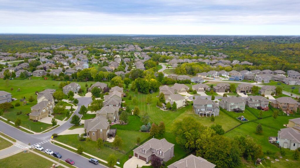
TOWN OF WAXHAW HAS EMERGED RECENTLY AS A IDEAL SUBURB FOR FAMILIES
Waxhaw’s quaint downtown, filled with restaurants and boutique stores, is a draw to the community’s deliberate approach to expansion. If your HOA is seeking new management, contact William Douglas Property Management today to discuss what we can do for your Waxhaw-based residents. With decades of experience in and around Waxhaw, we know first-hand how to keep your community thriving in the midst of change and development.
Regional Information on Waxhaw
Waxhaw, North Carolina, or the Town of Waxhaw, is located in Union County. Waxhaw is a suburb of Charlotte, North Carolina, and less than 20 miles from downtown Charlotte. The 2019 U.S. Census estimate for Waxhaw was 17,147. Waxhaw’s zip codes are 28173. The area code is 704. The town motto is “Proud of our past. Passionate about our future.”
Per the United States Census Bureau for Waxhaw
Historic Population
Census Pop. %±
1900 752 —
1910 602 −19.9%
1920 750 24.6%
1930 840 12.0%
1940 611 −27.3%
1950 818 33.9%
1960 729 −10.9%
1970 1,248 71.2%
1980 1,208 −3.2%
1990 1,294 7.1%
2000 2,625 102.9%
2010 9,859 275.6%
2019 17,147 (est.) 73.9%
Population per 2010 Census: 9,859
Male population: 48.4%
Female population: 51.6%
Population under 18 years: 32.5%
Population 65 years & over: 8.8%
High school graduate or higher 2015-2019: 97.1%
Bachelor’s degree or higher 2015-2019: 57.0%
Median home value 2015-2019: $329,400
Owner-occupied: 85.2%
Total households 2015-2019: 4,773
As of the 2012 U.S. Census, there were 1,273 businesses within the Town of Weddington.
An eastern area of Mecklenburg County and a western area of Anson county were formed into Union County in 1842. In 1843, the City of Monroe was founded as the county seat of Union County. It was named for President James Monroe. The 1850 U.S. Census for Union County calculated the population at 10,051. The 2010 Union County U.S. Census was 201,292, and the 2019 Census estimate was 244,562.
Waxhaw is situated in the southwestern part of Union County. Waxhaw was incorporated by the General Assembly, House Bill 1019, as a town in 1889. However, the Waxhaw settlement has been around since the 1720s.
Waxhaw Area History
In Waxhaw and across the South Carolina border into Lancaster County’s Indian Land, there have been accounts of both Catawba and Waxhaw Indians habituating these areas. There is historical debate on whether the Waxhaw Indians were a separate tribe from the Catawba Indians but actually a band of the Catawba people.
This debate revolves around the similarity in both the Catawbas and Waxhaw’s language and customs. One unique custom practiced by both tribes was the flattening of their infant’s foreheads. This custom resulted in the Waxhaw and Catawba people having eyes abnormally set further apart along with a sloping forehead. This deformity process was achieved by, shortly after birth, binding their infants to boards. The Waxhaw Indians, as did the Catawbas, covered their dwellings with tree bark. Similarly, as the Catawba lived in structured villages with a council house along with a large open area where tribal gatherings were held, so did the Waxhaw Indians.
The Yamasee War (1715-1717) was a war between European settlers and the Yamasee Indians in South Carolina. The genesis of this conflict was founded in the trading among the Native Americans and the settlers and traders and the Indian slave trade. The Yamasee Indians allied with over a dozen other Native American tribes, with two of these allies being the Waxhaw and Catawba. The Yamasee and their allies came close to completely wiping out the settlers in the South Carolina backcountry. With those settlers not being killed fleeing to Charles Town (Charleston, SC) to seek refuge. In the Native American’s attempts at dislodging the European settlers, reportedly over 400 settlers were killed. Individual farms and settlements were burned. The Yamasee allies all had varying degrees of involvement in the conflict. An unknown number of Native Americans were killed. This conflict so decimated the Waxhaw Indian population the tribe became extinct. There is a historical debate that at the end of the war, the surviving Waxhaw Indians disbanded and were absorbed into the Yamasee or Cheraw tribes. The Waxhaw Indians, as a separate tribe, if they were separate from the Catawba Indians, were considered extinct after 1717.
The first recorded inhabitants of the Waxhaw area in what would become Union County were the Catawba people or the Catawba Indians. The Catawba people, known as the Iswä (yeh is-WAH h’reh), had lived in the Catawba River basin for thousands of years. Iswä, in the Catawba language, translates to “people of the river.” Before the English colonization of the Carolinas, the Catawba people’s population was estimated to have possibly exceeded 25,000. European explorers, traders, and settlers introduced European diseases that had a devastating effect on the Catawba population. Smallpox is suspected of killing the most Catawba people or any one disease.
Smallpox historically developed into mass outbreaks infecting entire regions and entire countries. In the 18th century Europe, it is estimated that smallpox killed 400,000 people annually. By 1775, during the “1775-1782 North American smallpox epidemic,” the Catawba population had been reduced to around 400.
The Catawba population had only increased to 2,600 by the 2010 U.S. Census.
The first European settlers arrived in the Waxhaw area in the early 18th century. The Catawba people had a long history of being traders with other Indian tribes and traded with the new European arrivals. This commerce-based relationship helped maintain the peace between the Catawba Indians and the Europeans.
In the 1750s and 1760s, immigrants began arriving in greater numbers to the Union County and Waxhaw area. This influx of immigrants was largely Scots-Irish. These immigrants primarily arrived down the Great Wagon Road from Philadelphia. The left fork of the Great Wagon Road (The part of the road that led to Augusta, Georgia, via Lancaster and Camden, South Carolina.) was around 10 miles west of Waxhaw. For the most part, these new arrivals were subsistence farmers with a few tradesmen. Typically, even the tradesmen maintained subsistence farms.
The seventh President of the United States, Andrew Jackson (March 15, 1767 – June 8, 1845), was born in the Waxhaws to Scots-Irish colonists. His parents, Andrew and Elizabeth Hutchinson Jackson, had only emigrated to the Waxhaws from Northern Ireland two years earlier. It is presumed his parents landed in Philadelphia and traveled to the Waxhaws via the Great Wagon Road. Andrew Jackson’s father died in a farming accident before Andrew Jr. was born. His widowed mother took him and his brothers to live with nearby relatives.
Before he became the seventh president of the United States (1829 – 1837), Andrew Jackson was a lawyer, a politician (serving in both houses of Congress representing Tennessee), and a United States Army general. Jackson, as president, was an expansionist and ardent supporter of maintaining the Union. In addition, Jackson governed as the champion of the common man against the corrupt political aristocracy. His presidency was also the origination of the policy of Indian removal and the resulting Trail of Tears. His actions in support of the forceable removal of Native Americans from their ancestral lands and subsequent atrocities overshadow any of the positive accomplishments of his presidency.

There is a longstanding disagreement between North Carolina and South Carolina about the actual location of Andrew Jackson’s birthplace. Because of its remoteness, the state border area of Waxhaw had not been officially surveyed at the time of his birth. While there is evidence pointing to both states as his birthplace, both states claim him as a native son.
There was a Civil War skirmish at a general store called Wilson’s Store that was located near the intersection of Bigham and Brady roads in Waxhaw. After Sherman’s army had marched through South Carolina, leaving a path of destruction, his army feinted towards Charlotte. Confederate General Joseph Wheeler was sent to Waxhaw to resist the Union forces and to determine Sherman’s line of march.
On March 1, 1865, Wheeler put up a defensive line at Wilson’s Store. A small element of Union cavalry approached Wilson’s Store and was soon repulsed by a high volume of Confederate fire. After regrouping and receiving reinforcements, the Union cavalry advanced on Wilson’s Store for a second time. This second engagement lasted less than thirty minutes, and the Union cavalry retreated with three killed and an undetermined number of wounded. One Confederate soldier was wounded, and the Confederates forces captured five Union soldiers.
The Georgia, Carolina, and Northern Railroad (G.C. & N. Railroad) completed the railroad between Monroe and Waxhaw in 1888. The rail line was laid through the middle of Waxhaw, where it still lies today. The rail line was to reach from Monroe to Atlanta. However, in 1888 it reached just nine miles to Waxhaw. The rail line eventually reached Atlanta in 1892, but after the G.C. & N. Railroad had been purchased by another railroad.
The railroad became the largest economic driver for the area ever, up to that point. Agriculture being the economic base for the area since the early settlers, remained so until recent history. Cotton was a primary crop from the mid-1800s up until the mid-1900s for the area. Cotton cultivation was the leading cash crop in the area. Cash crops being crops raised specifically to sell and not consume. In 1888, the first year of the railroad, 2,000 bales of cotton were produced and sold. The following year over 5,000 bales of cotton was produced and sold. Cotton mills began arriving in the Waxhaw area in the later part of the 19th century as well.
This rural agricultural economic base continued well into the 20th century. Beginning in the 1990s, Charlotte’s ever-increasing economy has played a major factor in the growth of Union County and Waxhaw. This proximity to Charlotte has changed the economic base and is turning the area into a bedroom community for Charlotte commuters. Providence Road (U.S. Highway 16) and easy access to US Interstate 485 have turned Waxhaw into an easy commute for Charlotte workers.
Need Association Management?
Contact Us
How to Start
The Process of Working With Us


REQUEST A PROPOSAL
Request a proposal online or call us directly.


WE WILL REVIEW YOUR CASE
Our team of highly trained professionals will review your case.


RECEIVE A CUSTOM TAILORED PLAN
We will create a customized management plan for your community.


SEAMLESS TRANSITION
We will implement a seamless management transition and integrate our tech.


SIT BACK & RELAX
Enjoy better, affordable and a more reliable, hassle-free management system.
OUR REVIEWS
What Our Clients Say

We never lived in an area where they had HOA’s or property management companies before, so this is all new to us. Our experience with William Douglas PMC is kind of limited, but in recent months we have dealt with it more because our subdivision is being turned over to what will be our HOA very soon. I’ve had questions and each time I’ve contacted WDPMC I have received a timely response.

As Treasurer of our HOA, it’s a pleasure to work with William Douglas Property Management. They make our life so much easier!

This company has helped save our neighborhood.