
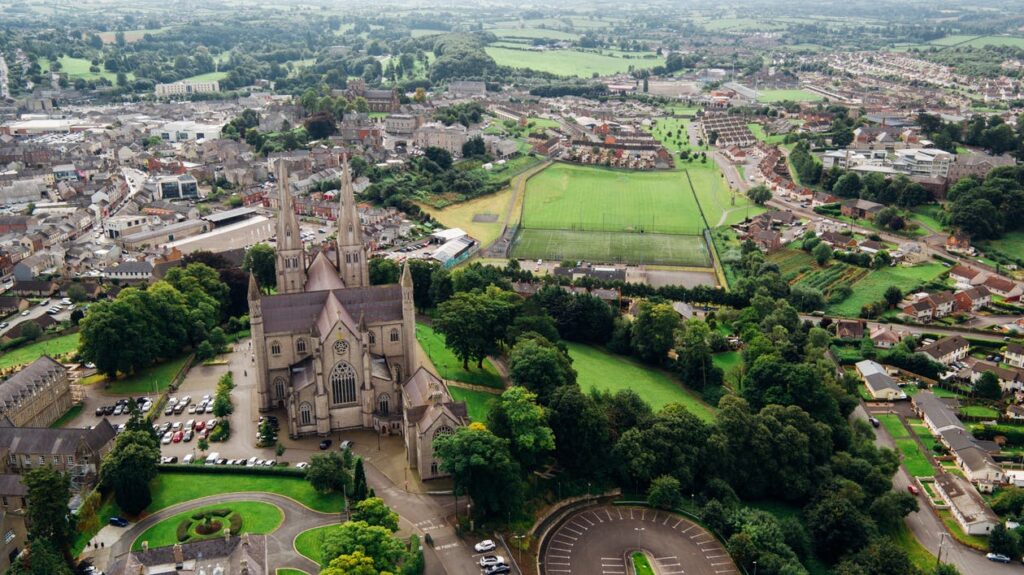
HOA management in Weddington, NC
William Douglas Management is a leader in customer service — the experience and expertise that your association needs and deserves!
Matthews to the north and Waxhaw to the south
As a suburb of Charlotte, Weddington has been part of the region’s growth over the past decades. Despite fairly significant changes in population density and development, the community is proud of its rural origins. With high expectations of their HOAs, Weddington residents can rest easy with William Douglas Property Management taking the helm. We have decades of experience managing homeowners associations in and around Weddington, meaning that we have a deep familiarity with this tight-knit suburban community.
Weddington, North Carolina, or the Town of Weddington, is located in Union County, with a part in Mecklenburg County. Weddington is a suburb of Charlotte, North Carolina, and less than 20 miles from downtown Charlotte. The 2019 U.S. Census estimate for Weddington was 11,182. Weddington’s zip codes are 28104 and 28173. The area code is 704.
Per the United States Census Bureau for Weddington
Historic Woodruff Population
Census Pop. %±
1990 3,803 —
2000 6,696 76.1%
2010 9,459 41.3%
2019 11,182 (est.) 18.2%
Population per 2010 Census: 9,459
Male population: 50.7%
Female population: 49.3%
Population under 18 years: 28.5%
Population 65 years & over: 13.7%
High school graduate or higher 2015-2019: 95.7%
Bachelor’s degree or higher 2015-2019: 61.7%
Median home value 2015-2019: $457,900
Owner-occupied: 95%
Total households 2015-2019: 3,424
As of the 2012 U.S. Census, there were 1,273 businesses within the Town of Weddington.
The first U.S. Census for Union County was 1850, and the population was 10,051. The 2010 population in Union County’s Census was 201,292, and the 2019 Census estimate was 244,562.
The origin of what became the town of Weddington dates back to October 1823, when a group of twenty-two farmers donated $262 to construct a church. This church was constructed at the “crossroads.” The crossroads, at that time, were where Weddington-to-Monroe Road (now N.C. Highway 84) and Providence Road intersected. Landowner Reuben Boswell (1755 – 1836) donated four acres of land for the church. The Methodist church was called the Sandy Ridge Society, as Methodist churches were known at that time. The church was dedicated in 1824 and had 23 charter members.
Reuben B. Weddington (1826 – 1901), Reuben Boswell’s grandson, in 1890, was asked to pay for the construction of a new church to replace the original church. Reuben Weddington donated the money for the construction of the new church, and he helped build a new two-story frame schoolhouse called Weddington Academy across Providence Road from the church. In 1899, the church congregation, to express their appreciation, changed the name of their church from Sandy Ridge to Weddington. After that, the two stores, the cotton gin, and the population began calling the area Weddington.
Union County was originally formed from sections of Mecklenburg and Anson counties in 1842. The county seat, Monroe, was founded in 1843. It was named for President James Monroe. Weddington was incorporated in 1983; however, the Weddington community has been around since the 1830s. Weddington is located in the southwestern part of the Union County
Weddington Area History and Other Interesting Aspects
The first recorded inhabitants of the area that would eventually become Union County were the Catawba people, or Catawba Indians. The Catawba people are also known as the Iswä (yeh is-WAH h’reh). Iswä, in the Catawba language, means “people of the river.” Before the British colonization of the Carolinas, it was estimated that the Catawba population of the Piedmont areas of North Carolina and South Carolina exceeded 25,000. Diseases introduced by European explorers, traders, and settlers had a devastating effect on the Catawba Indian population. Smallpox probably singlehandedly killed the most Catawbas of any one disease.
Smallpox was a very infectious disease that the World Health Organization (WHO) declared eradicated in 1980. Smallpox, before antiviral medications and modern medical practices, had an extremely high mortality rate. This mortality rate was compounded even higher with infants and small children. Smallpox historically appeared in mass outbreaks affecting entire regions and entire countries. It is estimated that 400,000 people died of the disease in 18th century Europe annually.
During the “1775-1782 North American smallpox epidemic,” General George Washington insisted on Continental troops being inoculated against smallpox, even with the associated risks. At that time, infections from the inoculation could be deadly. Washington understanding the underlying risks of the inoculation and is reported to have said, “Necessity not only authorizes but seems to require the measure, for should the disorder infect the Army . . . we should have more to dread from it, than from the Sword of the Enemy.” Washington’s inoculation program was one key factor in the Continental Army surviving the harsh winter at Valley Forge.
Compounded by the fact that the Catawba people had not built up immunities to these European diseases, by 1775, the Catawba population had been reduced to around 400. The Catawba Indian population from the 2010 U.S. Census had only increased to around 2,600 in those 235 years.
The Catawba people are believed to have inhabited the region along the Catawba River basin for thousands of years before European explorers arrived. While there are Indian artifacts found in the region dating back thousands of years, there is very little written record of the Catawba people before the 1700s. Believed to be the first European recorded contact with the Catawba people was with Spanish explorer Hernando de Soto in 1540. The next recorded European contact being in 1567 with Spanish explorer Juan Pardo. The explorer’s encounter with the Catawbas was documented in Vandera’s narratives of Pardo’s expedition. In the narratives, the Catawba people are referred to as the Ysa Issa (Iswä). The third documented exploration with the Catawba people was in 1670 with John Lederer. Lederer was a German explorer, who’s expedition was from Virginia to the western part of Carolina. His encounter is well documented in his The Discoveries of John Lederer, In three several Marches from Virginia, To the West of Carolina, And other parts of the Continent: Begun in March 1669, and ended in September 1670. In this work, he denoted the Catawbas as the Ushery.
From artifacts and oral histories, the Catawba people inhabited the Piedmont regions of present-day North Carolina, South Carolina, and up into Virginia. Primarily a settled agrarian-based people, the Catawbas supplement their agrarian diet with fishing and hunting. Catawbas lived in socially economically structured communities or villages. These villages varied in size but were typically constructed with palisades or walls of logs and tree branches surrounding the dwellings inside. The dwellings inside the palisades were small hut-like structures constructed of bark and tree limbs. The was a council house with an open area for community gatherings and functions. Sweat lodges being a large part of their society, the Catawbas typically constructed a stone circular sweat lodge within the village.
European settlers first arrived in the region in the early 18th century. For the most part, the Catawba people and the European settlers had a peaceful coexistence. Much of this peaceful relationship was based on the commerce of trade between each party. This beneficial relationship, in most cases, led to the Catawba Indians protecting the settlers from other Native Americans who were less than amenable to the settlers’ presence.
While the Catawba people have a long history in the region, they have a more recent history involving their reservation in York County, South Carolina, and the adjacent county bordering Union County in South Carolina, Lancaster County. The origin of the Indian lands or reservations goes back to the Catawba Indians allying with England during the French and Indian War (1754-1763). In recognition of the Catawba’s support during the war, King George III granted the Catawba Indians 144,000 acres in the 1763 Treaty of Augusta. That 144,000 acres, in present-day terms, would include Rock Hill, South Carolina, and most of the eastern part of York County. In addition, much of the northern portion or panhandle of Lancaster County and a portion of land extending into North Carolina. This part extending into present-day Union County goes over present-day Marvin, North Carolina, just south of Weddington. See the map from this time period below illustrating the Catawba Indian Reservation.
In the Weddington, Waxhaw, and Indian Land, South Carolina area, there have been accounts of both Catawba and Waxhaw Indians habituating these areas. It has been theorized that the Waxhaw Indians were not actually a separate tribe from the Catawba Indians but a branch of the Catawba people.
The Waxhaw Indian population was drastically reduced by the Yamasee War (1715-1717). Some historians contend the remaining Waxhaw Indians disbanded and were absorbed into the Yamasee tribe at the end of the war. The Waxhaw Indians as a tribe were extinct after 1717. The Waxhaw Indians are now considered extinct if they were a separate tribe from the Catawba.
The European settlers migrating into present-day Union County primarily traveled down the Great Wagon Road from Philadelphia. While the coastal ports of South Carolina and North Carolina had immigrants arriving every day, this could not come close to matching the volume of immigration into the port in Philadelphia. Additionally, roads and trails from the coastal areas into the Carolina backcountry were not as developed, nor was the Great Wagon Road.
The Great Wagon Road began as a migrating trail for herds of bison. Native Americans began using the animal-worn path for commerce with other Native Americans. As a result, the road became known as the “Indian Road” or the “Great Warriors’ Path.” Especially in the earliest days, after leaving the Philadelphia area, the road was a rough trail, much more so than a constructed road. This was especially the case in the Carolinas. The road began at Philadelphia and went through the Shenandoah Valley of Virginia into North Carolina, South Carolina, and ending in Georgia.
Beginning around 1750, the Great Wagon Road became the chief route of immigration into the backcountry of the Carolinas and Georgia. Around 1750, the road became the primary way early settlers migrated into the backcountry of the Carolinas and Georgia. While there were varied national origins for these immigrants, the Scotch-Irish and German immigrants made up the majority of the settlers. Many immigrants were immigrating due to religious persecution in their county of origin.
Settlers during this period were primarily subsistence farmers. Tradesmen seemed to have made up a small percentage of these immigrants. Still, many of these tradesmen farmed as well. Three religious’ groups, the Moravians, Lutherans, and the German Reformed Church, made up the majority of the religions immigrants brought with them to North Carolina.

The future Weddington and the surrounding area’s economic base when the settlers first arrived in the 1700s was agriculture. Cotton cultivation was the leading cash crop beginning in the mid-1800s. This rural agricultural economic base continued on well into the 20th century. Since the 1990s, Charlotte’s expanding economy has had a huge effect on Harrisburg’s economic and population growth. Providence Road (U.S. Highway 16) and the completion of US Interstate 485 have been a boom to the area as well. The school system, lower taxes, and the short commute have made Weddington into one of the fastest-growing towns in the region.
Charlotte’s growth or possible ambition led to Weddington incorporating into a town in 1983. There was much concern from the residents of Weddington that Charlotte was planning to annex their area into Charlotte. Even though Charlotte leaders at the time stated they had no plans to forcibly annex the Weddington area, the residents still sought to incorporate. NC House Representative Joe Hudson introduced House Bill 597, “AN ACT TO INCORPORATE THE TOWN OF WEDDINGTON IN UNION COUNTY.” The act became effective upon ratification on May 2, 1983. Weddington became Union County’s seventh municipality.
Weddington has grown drastically since 1983. There have been attempts to control growth by imposing bans on new construction and other zoning restrictions. These development restrictions met with mixed results. An interesting aspect of development within Weddington is the lack of commercial development in proportion to the residential development. This was done by design as well.
Need Association Management?
Contact Us
How to Start
The Process of Working With Us


REQUEST A PROPOSAL
Request a proposal online or call us directly.


WE WILL REVIEW YOUR CASE
Our team of highly trained professionals will review your case.


RECEIVE A CUSTOM TAILORED PLAN
We will create a customized management plan for your community.


SEAMLESS TRANSITION
We will implement a seamless management transition and integrate our tech.


SIT BACK & RELAX
Enjoy better, affordable and a more reliable, hassle-free management system.
OUR REVIEWS
What Our Clients Say

We never lived in an area where they had HOA’s or property management companies before, so this is all new to us. Our experience with William Douglas PMC is kind of limited, but in recent months we have dealt with it more because our subdivision is being turned over to what will be our HOA very soon. I’ve had questions and each time I’ve contacted WDPMC I have received a timely response.

As Treasurer of our HOA, it’s a pleasure to work with William Douglas Property Management. They make our life so much easier!

This company has helped save our neighborhood.